
A Field-Based Examinations of Early Agricultural Research, Public Interpretation, and Experimental Archaeology in the Tucson Basin
Allen Denoyer Outside of Pithouse at Steam Pump Ranch
Allen Denoyer formerly from Archaeology Southwest takes us back over 2,000 years to explore Tucson’s earliest agricultural communities. In this fascinating talk, Allen uncovers the lives of the people who cultivated corn long before the iconic Hohokam civilization, showing how careful excavation and keen observation reveal their homes, canals, and fields buried beneath the floodplains. From the discovery of ancient corn varieties to the intricate layout of early irrigation systems, he brings to life a world where ingenuity and survival went hand in hand. Perfect for anyone curious about the hidden stories beneath our modern city, this presentation connects the past to the present in a deeply human way.
For rough transcripts of each video, scroll down the page
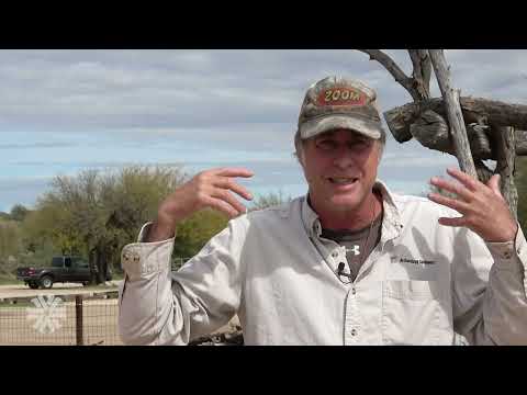
Hi everybody. Yeah, he said I work for an organization here in town called Archaeology Southwest. We’re a nonprofit, and we’re about preserving and protecting archaeological sites. We put out a magazine, so I didn’t bring any with me today, but oftentimes we have them. I’ll have them at Steam Pump Ranch. Many of you are probably familiar with our pit house that we have built there at Steam Pump Ranch. That is a replica of a Hohokam period house that is about 800–900 years in age range. That is much more recent than what I’m going to be talking about here today, but I will be out there this coming Saturday with outreach. We’ll have tables set up. You can go in the pit house and look at the pit house and check it out, and you can ask me more questions. I think you can ask me questions after I’m kind of done talking today. I blabber a long time, so if you don’t hear me just let me know and I’ll speak up a little louder.

Sketch of Hohokam Making Pit House
What I’m going to talk about is what we call now the Early Agricultural time period here in Tucson, Arizona. You’re all pretty familiar with the Hohokam stuff, the folks that were living here that you see their sites everywhere. If you go out to Catalina State Park you can go to Romero Ruins and you can see that really nicely preserved village in there.
What I’m going to talk about is the folks that were here before that, and very much likely they are the ancestors or the precursors to the Hohokam. These are the same peoples basically, but just later in time. We start calling folks the Hohokam when they start making pottery and painting the pottery. This early stuff that I’m talking about is back beyond 1,500 years ago to about 2,000 years ago. People were not using the bow and arrow yet, and they were not making pottery containers for storage.
The big thing in the Early Agricultural time periods that ties them together with the later Hohokam groups is that they were growing corn. Corn comes in first. This is a picture of an ear of Chapalote corn. It’s a popcorn and it has pretty small ears. This is considered to be probably the closest example of what the early corn would have looked like here. For the longest time we have been saying, from dates that we’ve gotten from sites that we’ve excavated down along the Santa Cruz River here in Tucson, that we had dates putting corn here about 4,000 years ago. With some more work that was just recently done in the last couple of years off of Ina Road where Ina and the interstate cross in that area, where there’s that big sewer plant, we call that site the Las Capas site. At that site some recent work down deep in there got some new dates on corn that are bordering on 5,000 years ago. We just keep pushing it back. It’s pretty amazing.
What I’m going to talk about today and show you in a bunch of these slides is how we find what we have found to learn about these early agriculturalists here in Tucson, and some of the techniques we use to find them. Then I’ll show you some of the artifacts and talk about all that stuff. If you really need to, you can ask me a question, but I’ll try to keep rolling through it.
This picture right here is a good example of what the early corn would have looked like when we find it. Here are a couple pictures of the Las Capas archaeological site, which is down off of Ina and the interstate. Every time the City of Tucson keeps growing and growing, every few years they have to expand the sewer plants. If there’s one thing you don’t want to have not enough capability to deal with, it’s raw sewage. They keep expanding the plants.
At Ina and the interstate there was a really great place for people prehistorically. What happened is that it’s a spot where the Rillito and the Cañada del Oro rivers run into the Santa Cruz River. They dump their loads of gravels and sands into the river, and it created somewhat of a natural dam in the river. It allowed the water table to come up to be very high near the surface. Much of the year through that stretch would actually have water above ground running through it. The river was not entrenched like it is now. If you go back in time to about 2,000 years ago, the floodplain was flat pretty much all the way across with the river meandering around in there. People could go in and dig canals out of that river and run them out onto the flat floodplain. That spot at Ina and the interstate was really great. For archaeologists it was also fantastic because one of the things that happens there is that every year there would be floods that would bury the fields and things, which helps us to be able to find them.
How do we find early agricultural sites in the first place? They’re not so obvious. Archaeologists, when people were starting to work down here, never really paid attention to this earlier stuff. They were looking for sherds and ceramics. They were looking on sites that tend to be up on the foothills and not down in the bottoms of the floodplains. We discovered that early agricultural sites tend to be down in the floodplains. The people were actually living down in the bottoms. Not until we started paying attention to that did we really notice it.
There are early agricultural villages up on the terrace tops, but in most cases they’re capped by later Hohokam sites, so we can’t see them as clearly. There are certain artifact types that we find through time in these sites that are diagnostic. The big one is sherds. When you see sherds, you know we start to see pottery coming in about 1,200 years ago. The earliest pottery was not decorated; it was just brown ware. They were making jars that didn’t have rims on them. Over the next 100–200 years they start to paint them. When they start to paint them is when we start to call them the Hohokam. That is just a word we put on them. It means nothing. Their ancestors are the modern O’odham tribes that are living here in this part of the world now. One of the things to think about is that there were multiple migrations. You have a group living here and then you have new groups coming up from the south moving through. Some groups moved up onto the Colorado Plateau. A lot of the archaeology I’m talking about today resembles the Ancestral Pueblo stuff as well. They’re closely related.
This slide shows people walking on a terrace probably above a river somewhere looking for artifacts. If you’re doing survey as an archaeologist, you’re looking for all artifacts: historic, prehistoric, whatever you find. The artifacts tell you what might be in that village. You look for certain things. This type of projectile point is called a San Pedro. It’s a very typical projectile point in the Early Agricultural time period. We see these all over the place. When you see something like that, you know you’ve got some earlier stuff going on there. We know this from excavations: how old they are, what the time frame is of their age, and what the people were doing to make a living at that point in time.
Once we’ve got a site and we know where it’s at, if it’s in the floodplain and there’s going to be development, we don’t just go out and dig sites randomly. There has to be some kind of project going on where there is funding. It’s generally federal or a developer doing a project that will impact a known archaeological site. Before work can go on, the first thing we do is go out with a backhoe and dig trenches like this. We look at the cross-sections of the dirt in the floodplain and we’re looking for features like pit houses and pits. What we have in the floodplains in Tucson is layers—layer after layer after layer. What’s on the surface of the ground is not necessarily any indication of what is below you. You can go through several different cultural layers in these locations. Unless there’s been disturbance kicking up sherds or flaked stone artifacts, we might not know that there’s an archaeological site there at all until we get in and look. A lot of projects start by digging backhoe trenches in the floodplain. Other technologies don’t work—we just have to get in there and look at it with our eyes.
This is to give you an idea of what I mean when I mention that there are multiple layers of stuff. When we are in the floodplain and we’re digging, this is a profile right here from over at the Las Capas site. This shows you all these layers that we have numbered and labeled so we can understand what we’re looking at. After a period of time we can recognize them. When there are floods, when there are huge storms in the summertime or wintertime and it rains everywhere, you get a lot of water coming down the rivers. Back in those days they weren’t entrenched, so the water would spread out across the floodplain and drop the sediments from the different areas during floods. At Las Capas, all these different layers represent floods, and each layer represents multiple floods. You can see micro smaller little layers in there. Each one of those layers is from a flood when it dropped its sediments across the floodplain.
We learned that 504 in this level is where you find the Cienega stuff, and the very top of it you find the Hohokam stuff and the later Spanish. Down in the floodplain in the Santa Cruz, the upper layers are all of that stuff. Once you start going down and get to the bottom of the 504 and going into the 505, you’re in the Early Agricultural period, and that’s where we find these earlier sites. They’re all over the floodplain. The floodplain is loaded with them. They’re everywhere.
Once we go into the Early Agricultural period we don’t have ceramics to tell us how old they are. One of our best things is projectile points, and carbon. These represent hearth features that you might find in there, and we get the dates from the charcoal from these features. If we dig enough features in a layer, we get a pretty good idea of the age range of that layer from people living there. The latest projectile point styles we get in that Early Agricultural time period are what we call Cienega. Cienega is a transition. Right after that is when ceramics come in. They’re building little round houses. We had a replica of one at Steam Pump Ranch for a number of years that we burned down. Some of you were probably there and may have seen it. It was really cool.
Before that, when you go back in time a little further, you go into the San Pedro time period, and you get these kinds of projectile points. The difference between these Cienega points right here is that the big thing in Cienega is that the bow and arrow comes in. We see this shift into these much smaller projectile points. If we go back in time before the bow and arrow, all the projectile points are much larger. These were used with the atlatl and darts. I have some examples of those I brought at the end of the talk that you guys can come up and look at.
Once we get into the San Pedro time period it lasts a long time. It is a long time period. Then you go through that into the early San Pedro and we get these high points. Below those we have Cortaro, and below them there’s another layer that we barely understand. We just don’t know much about it, but that’s the earliest folks when the corn is first coming in. The further back you go in time, the fewer people there are, the fewer sites there are, and the less of that material there is. It’s much harder for us to find. We have to get kind of lucky to find it.
I wanted to give you an idea of what we’re doing in these pictures. Once we’ve got these trenches dug, we’ve opened them up and we spend a lot of time looking at the soil and the layers in there. This one’s a really cool one right here. If you look carefully, you see this D-shaped thing right here. This is the bottom of a big canal, a good-sized canal. If you look carefully, it’s kind of hard to tell, but the canal comes up to almost this elevation here. Then there’s a bump and a berm right here.
This is a canal that was bringing water out of the river into the fields. Fred here is the soil geomorphologist that did a lot of the work for us out there. He is working on a much smaller little ditch, a field ditch that was out in the fields. He is drawing lines in the dirt representing the different layers and different things. This canal is pretty cool because it was filled in with a flood. This is a very white clean sand that filled it in from a fast-moving flood. They reused it, and up here is another dig-out and reuse of it. We look at that dirt carefully. We scrape it with really sharp trowels and break it down to micro layers. Over the years working on projects, every project we do we kept pushing it back further and further. We got new dates and it kept getting older and older. It was super exciting.
Here is another thing. This is a later time period site. This is an early ceramic time period site down near A-Mountain in that area. This is an example of an excavated pit house. We saw the pit house in the trench. This is the original trench we dug, and we could see the fill inside the house. Then we went back in and dug it by hand. You can see artifacts sitting on the floor of it, and that’s the entryway right there.
In the floodplain when we’re digging and we start to look, we learned that we could see agricultural fields. This gentleman running the backhoe right here, his name is Dan Arnett. That’s all he does—archaeology backhoe work. He built this blade. It’s a big metal blade with a scraping bar on the end that he sharpens so sharp you could cut your finger if you ran it down it. He can cut the dirt and scrape it, so it’s like using a giant trowel. We can scrape in the floodplain with it and do a pattern. You scrape it down and then we blow it off with blowers and we can see the fields. We’ve discovered that we can see the agricultural fields.
There’s always an archaeologist standing very near monitoring the machine in case we come across human remains or looking for features, so we don’t destroy them. Dan is very good. He tends to see the stuff before we even do. You can see right here behind this gentleman with the blower, this line that we painted in the ground. When we first start out, we see differences in color in the soils, so we start to spray-paint those. Over time, as we expand our excavations, we start to see things like this.
This is a map, an excavation map of an in-field excavation. This is a plot of land right off of Ina Road when you go across the interstate. They built a warehouse at the sewer plant there at Ina for storing materials and things. We did this excavation before they built the warehouse. We dug down about a meter and a half into the bottom layers. This is a layer of agricultural fields that we exposed. The first thing you can see are these trenches we dug initially looking for agricultural features. In those trenches we could only see these larger canals. Once we started stripping with the backhoe, we started to see the berms. Every canal had mounds of dirt on each side. Out in the fields they had little ditches that ran off the sides. They dug lateral ditches and built little berms around agricultural field plots.
They would plug the main ditch and run the water down into the little field cells. They tend to run two wide and then several long until you get to the next bigger ditch. It’s laid out in a grid pattern. Down there in the Santa Cruz there are layers upon layers of these things. With the backhoe we have to strip really carefully so we can see these. Here’s an example of what I was talking about with how they made these fields and ditches. They would dig a channel into the lower sediments and use all that dirt to berm it up to create those berms. We can see that in the cross-section. We can see the remnants of layers that were there that they dug out, and we can see the broken up little colored remnants of that strip right there. They would run the water out into the fields at a level that was higher than the ground surface, so all they would have to do is cut a little hole in it and run the water out this side. The equivalent of it is like a garden hose. It’s a way of moving the water around in the fields, because if you have a huge area and it’s all coming in one little ditch, it’s like trying to water your backyard with a hose running in one spot. You have to move the hose around. These ditches and berms were a way of doing that.
Here’s another example of the dirt dug out. These are fields. What happens is you’ll have floods and the flood waters come in and deposit clays into the interiors of the fields. In the spring they’re running water down their ditches into the fields, and we get layers of clay. These are all things we can see when we’re stripping with the backhoe. The berm is built out of this lightly colored dirt that’s a little mottled, and then there are these clays. When we’re stripping with the backhoe we cut the top of this off and we can see stripes everywhere. It’s a different color. Those are what we’re painting in these pictures.
This is an example at a site where we actually excavated the fields three-dimensionally. Instead of scraping the top off, we dug down. This is the bottom of the canal ditch, this is the berm on this side, and this is the berm on this side. These are fields. There’s a berm that runs off here, another one goes here, and these are big, huge fields. This is a site down off of where we found the footprints, where they built that new road across while doing all that work along the interstate. Dan, the backhoe operator, was stripping over the top of one of these berms and he saw a shape that looked like a footprint. He hopped out of the tractor, grabbed a blower, and blew it out with a brush. You could see the toes and everything. You could see the footprints of the farmers walking around in these fields. At this location you can see there are layers and layers of these layers with footprints in them.
The other thing we can see are planting pits. The holes they dug to plant the seeds of the corn. We can see the full system in the fields. They show up amazingly well. Here’s a picture that shows you what I’m talking about. We’ve just recently stripped over this surface and we’re blowing it off. You can see the color difference. These are berms right here, and these are the interiors of the fields. In this location the interiors of the fields filled up with lighter colored sediment, more sandy, silty. The berms had more clay in them, so they’re darker and look darker. This area where you don’t see any berms—we stripped too deep and missed it. The difference between here and here is about five centimeters. It’s like a couple scrapes. Sometimes these berms melt down to almost nothing, so we don’t have a lot to go with if they weather out and are pretty far gone. This site is down off Ruthrauff Road, and we were literally under the west lanes of the interstate while working.
Here’s another example looking off the boom as he’s digging and exposing these fields. We’re just exposing vast areas of dirt. It’s all about the dirt. This is once again off Ina Road. The gas station up the interstate is right up here. We’re out in these fields exposing them. This is another view of the same fields I showed you earlier on the hand-drawn map. You can see how complicated it gets. This section of fields was very far out in the field systems, so the fields are very small. If you’re closer to where there’s more water, the fields can be much bigger because you have more head of water. These field cells are small. There’s a person standing there, though it’s hard to see. They’re not too big. These little berms you see are trenches we cut across so we can do the profiles of the canals and draw them to see what’s going on.
Here’s another one. I’m kind of into the dirt stuff. If you look closely, you can see there’s a line right here and a line right here. This is the interior of a canal or field ditch. This is a berm, and over here is another berm which we haven’t stripped past yet. If you look closely, later on they had fields cutting over the top. All these little round holes everywhere are planting pits that cut into these sediments from higher up fields. Right here is another berm that matches this one exactly. That’s a layer of the same ditch or canal running along that has been used through multiple flood episodes.
When you have a flood that’s not too strong and the flood water spreads out across the floodplain, it envelops everything. As the flood slows down it starts dropping its sediments. The first thing it drops is sand, then silts, then clays. All of these little bands represent different floods. If you look at the top it’s dark—that’s clay. The bottom is sand. Sand, silts, clay. Layer upon layer. They didn’t drop enough sediment to obliterate the field systems, so people would come back, rework them a little bit, and keep using that same field system. Over however long it took—though we don’t know how many years this represents between here and here—it reflects those patterns through time.
Here’s another picture of that same field set of canals. You can see the upper one right here, berm, another berm, the ditch, and berms on each side. It’s amazing. The floodplain down there is just that everywhere you go. People have been growing corn down there for over 5,000 years. Everywhere you go there’s evidence of folks doing stuff in the floodplain.
Here’s another example. These are the fields that had the footprints. There’s the main big ditch, another one here, and lateral ditches running along. All the little green things are planting pits. These shapes that look like people walking around in the mud are footprints. Those are prehistoric footprints of farmers. We had a spot where we could see people walking from one corner of the field across to another place. In the corners is where they would dig a hole through the berm and run water into the fields. We could see what direction the water was coming from.
These fields are in the Cañada del Oro drainage, not the Santa Cruz floodplain, though the Santa Cruz River is nearby. The water they were using was coming down the Cañada del Oro. We can tell by the color of the sediments. Floods coming down the Santa Cruz have a different sediment color than floods from the Cañada del Oro or the Rillito because the geology is different. It’s really cool.
Here we are out doing work with volunteers. They came out to help us dig. We were exposing the footprints and the berms of those fields. Here’s an artist reconstruction of field cells. You have the ditch running with water, then you turn the water laterally down a ditch and run it into the fields. This drawing is a little inaccurate. Often, they opened them in the corners so they could water two field cells at the same time. There were footprints in the fields and you could see the squish out around them. It was amazing.
Here’s one where the person was wearing a sandal. There are no toes in it, just a rectangular shape, but the squish marks were phenomenal. Specialists came and made casts of many of these footprints. The Tohono O’odham museum has them stored out there. The community was really excited about it because you can actually see the people walking around doing the farming. Even though everything is made by people, seeing the footprints brings it right home. We had tours, and thousands of people here in Tucson got to go through and look at it.
Here are more pictures of the fields. We wore socks instead of shoes so we didn’t disturb the dirt very much. The age range of these fields we believe is around 3,000 years ago. Underneath this set of fields there are about 12 or 13 layers of fields buried underneath. In a couple of the lower layers they could see footprints there too. It’s pretty amazing.
I’m just going to go into looking at archaeological features now, other kinds of things. This is a fire hearth right here where we stripped over it with the backhoe. This is charcoal. We could see this charcoal and the outline of the pit. Outside it is just clean sediments. We strip down until we can see it, spray paint a line and then bring in our archaeologists. They dig it by hand with trowels and brooms and take samples out of it. The charcoal is really good for us. That’s what we get our dates out of. That’s where we get our corn. In the floodplain things like corn do not preserve. It’s going to rot and go away unless it’s burned. If it’s burned, then we’ll find it. We take a sample of this dirt with the charcoal and float it in a bucket or machine. Charcoal floats to the top. We scoop it off, then go through it and pick out corn, seeds, and anything preserved like that. When we see annuals, things like corn and maybe squash seeds, we collect those. At this time period we do not have beans yet. We don’t see beans. We see mesquite beans. They were definitely using lots of mesquite beans, cholla buds, and all the native plants. We don’t see the domesticated beans coming in yet. That’s a good example of what a fire hearth looks like when you excavate it.
There are lots of pits. These people didn’t have pottery, but they had baskets. They were using baskets for everything. We don’t see the baskets unless they’re burned. Sometimes we find fragments. We do find large storage pits. This pit is very big, and you can see layers of how it filled in and washed in. This is called a bell-shaped pit. The bottom of the pit is much bigger in diameter than the top. It’s like a container. These pits have been found filled with corn that combusted. The corn spontaneously combusted and burned, but because there was no oxygen it didn’t turn to ash. We can find that corn preserved. There was a project that found a bell pit so full of corn that they only collected a little bit and had to throw the rest away because there was so much. It was all charred. There were little bugs in there. Everything gets preserved. That gives you an idea of how big some of those pits are. You could spend a week digging one of those things. Sometimes there’s more dirt in one of those big bell pits than in a pit house.
Do you guys know what a pit house is? A pit house is when people build a house by digging a hole in the ground and building the house out of that hole. These houses were built out of willow and other river materials and thatched with grasses and reeds. Mud was put over the roof. Here are some pit houses we excavated at Las Capas. We stripped with the backhoe and could see the outline of the house. Then we came in and dug them by hand. This was a very shallow house. These holes running around the outside are post holes for outer posts that went around the edge of the house. They bent them over and tied them across the top and thatched them. This is a storage pit inside the house, and here’s another one.
Down here you have another house that’s a little deeper and round. It had storage pits here and here. This one is kind of weird because it goes into the wall, but it was contemporary with the house. This house burned down, so we found lots of lumps of burned mud from the roof and charcoal across it, which gives us good dates. It was loaded with ground stone. It was like they abandoned it or accidentally burned it down and left everything in it.
Here’s another house that didn’t burn so heavily but has a nice storage pit in it. We thought there was going to be a house here, but we couldn’t make any sense of it. Sometimes things are just too chewed up because of rodents and other disturbances. These round houses are from the Cienega time period, about 1,500 to 2,000 years ago. The San Pedro ones are about 2,000 to 3,500 years old. These dates are general ranges. I’m simplifying because it’s more complicated than that. We can’t get really tight dates on this early material like we can with ceramics in later Hohokam time periods. Pottery changes through time much quicker. We can determine pottery types by how they’re painted and made, sometimes down to a 50-year period if we’re lucky. In this earlier time period the dates are much broader.
Here’s an example of the pit house we built over at Steam Pump Ranch. This is what that little round house might have looked like. The beams go up around the edges, it’s thatched with reeds and grass, and mud is placed over the roof. We burned this one down a number of years ago. It was super exciting. If you go to the Archaeology Southwest website or our YouTube channel, you can watch the video of us burning it down.
Audience member: Excuse me, why did you burn it down?
Allen: We find so many prehistoric houses burned down that we wanted to see how easy it would be to do that and why it might happen. One theory is that if somebody died in the house, they would destroy it and leave the artifacts inside. We find burned pit houses that have nothing in them, and others that have everything left inside. It would have been easy to go back into a burned house and pull-out things like manos, metates, or whole pots to reuse, but often they didn’t. They just left them. It was a way of closing the house off and sealing it. That was a big reason why we wanted to do that.
These little grass houses from the Cienega period were thatched with grass. When they burn and collapse, the dirt from the roof falls on top and smothers the fire so the structure doesn’t completely turn to ash. That allows us to see construction details like vertical posts and interior posts. From those remains we can reconstruct what the houses looked like.
Here’s another house reconstruction. This one is a historic O’odham house at the Salt River Indian Community near Phoenix. They have a small museum, and we built this house there. She’s putting arrow weed into the walls right now. We recently remodeled this house again. I’ve been working on this house with them for about four or five years now. It’s pretty cool.
Here we are at Las Capas after exposing the fields. We thought it would be fun to replant a field. We built berms around it, used digging sticks, planted corn, and grew some corn there. We had stripped acres of land at the site. The rabbits and other animals kept getting the corn, so we had to put little cages around it to protect it. We watered it using a water truck. One thing you can see in these fields is how much clay is in the soil. When it dries it cracks badly. This would not have been great for growing corn. All this clay came from running water from the Santa Cruz River into the fields over time. The suspended clay particles settled into the fields. Eventually the soil becomes so clay-rich that it cracks badly, and water runs down the cracks during storms. That begins erosion and downcutting toward the river channel. We started finding strange features in the fields—irregular shapes with trash and artifacts in them. At first, we thought they were wells dug to reach water. Eventually we realized they were piping vents.
These happen when water runs down cracks or holes in the ground and begins cutting channels underground. If one of those forms in your irrigation ditch, it can destroy your canal and field system. Once it starts it’s almost impossible to stop. They didn’t use rocks in these irrigation systems. Everything was mud and berms, so they had to watch the system carefully.
Through most of the Early Agricultural time period the weapon was the atlatl. I’m pretty partial to atlatls. I have one up here and a dart. Often, I’ll have them out at Steam Pump Ranch and you guys can try them out. They’re super fun. It’s just a stick with a hook on one end and you throw a long spear like this guy right here. When they made their projectile points, they hafted them to a short stick that socketed into the front end of the dart. We call them fore shafts. I have some up here you can look at. They made much larger projectile points than we see later with the bow and arrow. With the bow and arrow the projectile points are very tiny because they’re shooting a small arrow. With the atlatl darts they’re shooting a much larger projectile point. When you hit an animal, it does a lot of damage. You only get one shot unless there are multiple hunters because the animal is going to run off. We do get deer from these sites and of the medium game we get deer and bighorn sheep. On the outskirts of Tucson from time to time, we see antelope bones. There’s no bison and nothing like that. There are no javelina either. Javelina weren’t here yet. They’re recent arrivals that came in the last 50 to 75 years. If you go look at old western movies you never see anyone hunting javelina. That gives you an idea how recent they are here.
Here are some projectile points. These are from Los Pozos, another site down off Roger Road under the old sewer plant. You can see three different time periods represented. These are San Pedro projectile points made out of rhyolite. This rhyolite comes out of the Tucson Mountains on the north end out there off Ina. It’s horrible stuff to work with. I hate flintknapping it, but they were using it.
Here you have some Cienega points. These are early Cienega points. They’re corner notched and they’re arrow points, much smaller than the dart points. Some researchers think these larger points continued in Cienega times but were used as knives rather than projectile points. These points over here are early ceramic period points, the earliest Hohokam style projectile points. When you dig a site, you’re going to get all these things mixed together because there are many layers and rodents move things around. You might find a later projectile point down in a San Pedro level because of bioturbation. It’s important to pay close attention when you’re digging.
Here are some replica points that I made that are hafted onto fore shafts. I do a lot of experimental archaeology where we make things like this and shoot them to see how they break. By studying breakage patterns, we can understand what we’re seeing in archaeological sites. Sometimes when you’re excavating you wonder why something was made a certain way. Making and testing replicas helps answer those questions.
This is another San Pedro point. In the Early Agricultural sites, we also get some clay artifacts. We find fragments of figurines made from clay. We think these were accidentally fired rather than intentionally fired. They probably came from pit houses that burned down. These are fragments of some of them. We also get shell artifacts. There was shell trade coming in during this time though not as much as during later Hohokam periods when there was a lot of shell. This projectile point here is made from non-local stone. We see points made from materials that likely came from far away.
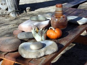
Here’s a really interesting one. This is an Early Agricultural figurine from the Empire phase, early San Pedro. It’s about 3,500 to nearly 4,000 years old. It’s the only intact one I’ve ever seen come out of a pit house. You can see it’s a female figure. Later in time during Cienega times you start getting figurines that look like this. It’s like they’re taking two figures and sticking them together into one. They’re pretty graphic and interesting. People interpret them in different ways. Another difference in Early Agricultural sites is the grinding technology. Later Hohokam grinding stones are different but in the earlier time periods the metates are slab like with a basin in them. They used a single one handed mano to grind corn. This is another example of a basin metate. These are from the Santa Cruz area. We had a spot at Las Capas where we found a lot of ground stone tools made out of quartz. That must have been really difficult to make because quartz tends to break apart when you work it. Making ground stone tools involves pecking them with another rock over and over to shape them.
Here are some more examples. This is a stone bowl that we see in Early Agricultural contexts. Many of these bowls have knobs on them. We don’t see those later on. These might be precursors to Hohokam palettes, those decorated trays you sometimes see in Hohokam sites. That’s a guess but it’s possible. Another artifact we find are these scapula tools. These examples are from Utah, but we find the same kind of artifact here. They’re elk scapula bones with serrated edges. They were used as rakes for gathering seeds. You’d pull grass over a basket and rake through it to collect the seeds. The teeth on these tools are polished from rubbing against grasses which contain silica that creates a smooth polish.
This is a pipe made from vesicular basalt. A hole was pecked in from one end and another hole from the other end until they met in the middle. A bone tube would be inserted and sealed with clay. It may have been used like a cloud blower. We see similar objects in Pueblo areas to the north but down here once you get into Cienega times these pipes disappear. There are no pipes in Hohokam contexts except for one example I found in a pit house along Silverbell Road. That one must have been an heirloom object someone kept.
Here are some beads made from spiny oyster shell which has a bright orange color. There are also two turquoise beads. We found these while scraping fields. One bead popped up while we were working with the machine. I marked the spot with a flag and later came back to investigate. When I scraped the area again another turquoise bead popped out and broke. Inside that small mound of dirt were about 11 or 12 beads. It had been a necklace. The beads were drilled from both ends. That necklace would have been beautiful. Here are more bead examples from Los Pozos from Cienega times. These are Olivella shells which are common throughout the entire sequence. They show that trade networks were already in place.
AI provided by Pima Community College:

Pit House Replica at Steam Pump Ranch in the Heritage Garden.
My name is Allan Denoyer, and I work for a nonprofit here in Tucson called Archeology Southwest and we specialize in protection and preserving of archeological resources and trying
to get the Native American perspective on the past out to people now. My job with Archeology Southwest, is to teach people how people made things prehistorically, how they did the things they did to make a living, to live their lives. And so here at Steam Pump Ranch, we built this replica of a Hohokam style pit house. This house is based on houses that were excavated archeologically up the road here. This house is a Hohokam style pit house and when the archeologists go out on these sites to excavate these houses, they use backhoes. They come in and they scrape the surface of the ground off and expose the pits that the prehistoric people dug to build the houses out of and then they go in with picks and shovels and trowels and brooms and stuff and excavate all that dirt out of those holes to see the outline of the pit that the people built in the house.
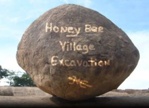
So, this house is based on houses that we saw in those excavations up there at Honeybee Village
in Rancho Vistoso. So, when people built houses like this, they did not have blueprints to build
these houses, although they had a pattern that they used. So, everybody living in a village at
this time basically built their houses the same way; but their blueprint was in their heads.
They knew when I build a house and attributes and everybody more or less followed those and
a lot of that is based on the materials that they had available to build their houses with. So,
depending on what you had growing in the washes around here, depended on what you used.
And so here at this house, one of the big resources, one of the big things they used was dirt or
mud to make the house with. And so, when they came in and they built a house, they dug this
big pit in the ground and then they built their house out of it.
Sketch of Hohokam Making Pit House
And a way to think about that is their house is kind of like a basket; so, it has a superstructure.
And then they weave willows and reeds around the interior, and then they would mud over the
roofs and then oftentimes they would mud the sides, or they would just have thatched grasses
on the sides. And then they built a big berm around the edge that that was higher than the
ground surface so that when it rained, the water wouldn’t flood into the house. And so, a big deal with these was to keep the rain, the water out. So, the mud roofs shed the water really nice and then the grass thatching on the sides would allow the water to run down the sides and the mud berms on the outside, the thatching would go over the top of those berms and shed the water outside the house. So, you could keep these houses relatively dry. These Hohokam folks, and here in Tucson, were growing corn, beans and squash – the three sisters. And so, you had to store a lot of those foods and things to keep them dry so they wouldn’t rot or fall apart. So, it was really important to keep the interior of your house as dry. That’s where you would have been doing that. People learned how to build pit houses long, long ago. Some of the earliest structures that we see in the southwest, the earliest houses and things, they’re all pit houses. We’ve had… There’s pit houses in this part of the world that go back probably seven or 8000 years old, way before agriculture.
We see corn coming in here in the Tucson basin about 4000 years ago. And when we excavate
those villages, we find pit houses all over the place. And they were living in pretty decent
villages along waterways. By the time the Hohokam are building pit houses like this, they’re
much larger. They’re much more sturdy than the earlier pit houses. The earlier pit houses are
built with more grass, less mud, and they’re not nearly as big around. This house that we built
right here is based on a house, a Honeybee Village that was probably twice the size of this one I
built. When we came in to build it, I was having a hard time finding resources to get it. So, when the archeologists were excavating at Honeybee Village, they had a lot of pit houses that had burned down and so when I pitched house burns down, sometimes the mud on the roof will collapse in on that house and smother out the burning logs so they don’t turn to ash. So as archeologists, when we come in excavate these houses, we map those burn logs, all the cross pieces, all the materials that are used in there. And we take samples of them that we can get species ID’d. So, we know the kind of woods they were using. So, what was really cool at Honeybee was, is they found logs that had come off of Mt. Lemmon. So, people actually went all the way up to Mount Lemmon to get some of the building materials they used in these houses. So, a group of folks have been for a number of years, have been exploring along the mountains around here to find good trails up to Mt. Lemmon, where they may have carried these logs down to here.
About five or six years ago, we built a little teeny sort of a replica of an earlier time period house. So back in the day, during the Cienega time period, people were building round houses.
And the Cienega time period about is about 2000 years ago, maybe 500 years on each side of
that. This was before people were making pottery. When people start making pottery and
they’re decorating it, that’s what we call the Hohokam. But those people’s ancestors, where we call down here, are the early agriculturalists or the early aged people. They were growing corn and they were they had irrigation canals and they had fields everywhere, wherever they could get them out of the rivers. Well, do is from houses that we’ve excavated down along the Santa Cruz River. We’ve dug numbers of those that have been burned down. And so, we built a little replica one that was two meters in diameter. And we burned it down. We wanted to see how fast one of these houses would burn down because we find so many burnt down. It was made of willows that were bent over like look of a magical little African hut kind of with a domed roof. And then grass thatching all over it and then mud on the top and a big berm around the side but open grasses around the edges. So, we went in I took a shovel of coals over there a hot coal and just dumped them inside the door into that house that fire. It went boom right up the sidewalls of that house. And in minutes it had burned down to where the roof collapsed.
And being an archeologist that has excavated a lot of pit houses, what was really, really cool was
as that roof collapsed, the side of the house that it started burning. First the beams started the
wall beams things started to collapse out. And when the roof finally collapsed. It sort of flipped
up and went upside down and landed on the floor and all of the building materials part of
that roof was on one side of the house. I can’t tell you how many times I’ve excavated pit houses where you find all kinds of burned material on one side of the house and none on the other. It’s like, “Well why is this?” There it was boom! So, you could almost study the fire the burn to learn like where the fire started and do a little research on that, so that was really cool. Really, really exciting to see that happen.
So, the whole Hohokam region that we call the Hohokam stuff goes well above like the Phoenix
Basin up north of the Phoenix Basin, and it goes clear over to like past Safford over into the
Safford Valley to the east. And then the solid Hohokam stuff is down along that border like the
US Mexico border now. You start to get it transitioned into some slightly different stuff going on down their groups but kind of this whole region and to the west out past Tucson clear out by cells you see Hohokam stuff out there the Tohono O’odham folks all consider the whole Hohokam their ancestors and it’s really easy to see that definition. They lived the same lifeways.
When folks came in here historically, they were living in very similar houses to these to these
kinds of pit houses like this. And so, there was a big crash of folks back in back when the Spanish arrived. And before that, diseases rolled through populations crashed.
So, when the Spanish and folks rolled through these areas there weren’t a lot of people
everywhere. Our villages were small and in isolated places. So, a lot of people had a hard time
seeing these people as the ancestors of the Hohokam. But clearly, they were. Their knowledge
of the desert of the plants is intimate, intimate, intimate. They’ve been living here for over
years growing corn. And through time the other three sisters come in squash and beans.
And so, we see them later and later in time. But corn was one of the very first big ones. And
then they’re using all the other natural resources out here mesquite beans. And you could just
go down the list a mile long. So, there was a lot of resources for these people to use here. It was
a very good place to live. So, Casa Grande ruins – their construction techniques are way different than what we see in these pit house villages. but they’re coming out of the same traditions. It’s the same stock of people.
What happened was in the there was a migration of people from up north from the Kayenta Anasazi region that moved down here and built villages along the San Pedro River down here along the Santa Cruz in a few places here in town. These migrants came in and they built their little their little villages their little enclaves. And over the next couple of hundred years everybody else who was already here sort of said, “Oh, you guys are cool.” And they sort of coalesced with these people into what we call the Salado phenomenon. And so, everybody starts to build houses that are above ground. And in this part of the world where there wasn’t a lot of rock for masonry, they’re building puddled adobe walls like Casa Grande ruins. So, they’re using rocks at the bases of the walls and then they’re mixing in pits like this.
Right here is one of the pits we use for the mud for this. They would mix the mud in pits, take
baskets and put it on these walls and form the walls up with their hands. They weren’t making
formal bricks like the Spanish taught everybody to use when they came in. Although there are
some examples where people were doing that in the southwest a little bit. But mostly its mixing
in the pits, putting on the walls and forming up with their hands to make those walls.
If you’re ever out hiking in the desert and you walk across a spot where you see these linear
alignments of vertical rocks sometimes parallel rows or single rows those are called the
semental stones. Those are the basis of walls for that time periods of houses and the ceramics
on those sites will be polychrome. They’ll have three colors of paint. They’re all made on brown
workplace down here in the southwest. They’re all made on brown workplace down here in
the southwest. And we like to lay those over the top of the fire hearth. They’re using these
brown where the clays all fire brown. This mud here is good enough. You could make pottery
out of it. There’s enough clay in it that you could. You could make a pot out of it and fire it. And
it would work; it would function.
When we excavate these sites, these pit houses like this, what I mentioned before, that the pit
house is there is a predetermined shape that they make them. And so, all these pit houses had
entryway ramps that went descended down into the pit house. And so, when we excavate these
houses, what we see inside them is posthole patterns. So, we can see patterns of posts that ring
both sides of this entryway ramp down into the house and around the outside of the house.
And then oftentimes we see two big post holes in the middle where they put two posts in the
middle, and then they would lay a log across the middle of those. And in a lot of cases, for the
bigger pit houses, those logs for these bigger poles are the wood they’re getting up on Mount
Lemmon. It’s kind of hard-to-find big mesquite trees that are really straight, so those logs would
have been really great for those parts of these houses. And so, we can see the layout of these
houses. And then from burnt houses we find sections of walls and roof sections sometimes that are still pretty intact. So, we can see the construction and then the rest of it is just plain guessing; we just don’t know.
But in these houses, when you excavate one of these houses, it’s like clockwork. So, if you’re
stripping with a backhoe and you find the outline of the house, if it’s not abutting other houses,
you see that outline of the house, it’s going to be a sort of an oval, rectangular shape. And in the
middle of that, there’s going to be a little rectangular space thing that comes out that is the
entryway. And so, when you excavated that tapers down into the house and then you go about
maybe centimeters a meter into the house, you find the fire hearth. And so, when we strip one of these houses with the backhoe and we can see the outline of the house, we sometimes don’t excavate the whole house. We put a unit in there, a one-by-one meter unit or a two-by-two-meter unit. And we like to lay those over the top of the fire hearth. We find them manos and the metates they used to grind the corn with.
Heritage Garden at Steam Pump Ranch
So, we come down on the hearth and so we can see that hearth and, you know, yep, we’re in
the house. We know the layout of it. If the house is burned, like a lot of times when we find
structures like this, the way we find them, you can walk on to an archaeological site where
there are millions of pit houses. And you won’t know from the surface. You can’t see them.
They’re all filled in. We go out with backhoes, and we dig trenches across the site. Every twenty meters, we dig a trench. So, then we go with our trowels, and we face those trenches and we look at the features in profile to see where they’re at. So, then we say, “Oh, there’s a pit house here.” And when we have those profiles, we can tell if the pit house burned. There’s a layer of charcoal and ash in those houses. Those are the houses we tend to go after the most, because oftentimes or fairly often those are the houses that we find floor assemblages and we find pots on the floor, we find them manos and the metates they used to grind the corn with.
We get a lot more information out of those houses as opposed to the houses that were
abandoned but not burned out. And they just slowly collapse in and fall apart. We don’t get as
much data out of those, so we sort of try to target the houses where we get more data out of.
Inside a house like this, if you when you go into the house, what you’re going to see the first
thing you’re going to see is you’re going to see the two vertical posts that are holding that main
beam across in there. And right in between them, you’re going to see the fire hearth. That’s it’s
a little bit to the entryway side. You’ll see that.
And then in this style of pit house, you’re going to see that it has the walls are actually
originating from a little way up in the pit. So, there’s two kinds of pit houses. Some pit houses
the walls originate from the bottom of the pit and others; they originate from the sidewalls of
the pit. So, this pit house has a little bench around the interior that you can kind of sit on and
hang out on. But the bulk of the pit houses that I’ve excavated in over the years, most of the
walls go all the way down to the floor in those houses, and then you’ll see the materials used to
construct it. And it looks like I like to equate it to a woven basket.
So, there’s actually two styles in this house. This one side is more of like a wicker shaped, and
that’s what we initially did on the house. But over the years, the sidewalls in the winters from
the rains come in on it, they get soaked. And what…This is a big thing I’ve discovered in this; this is this is really big is that when you have massive, huge rains and the mud gets saturated like a hundred-year flood type things are big rain events.

School Field Trip with Paul Canez and Kids in Pit House, October 2025
The mud on the sidewalls gets saturated and at a point it gets so heavy it just sloughs off. And
it’s the same kind of erosion you see on adobe walls in historic structures. If they’re left
unprotected, it gets really wet and the tops of those walls sloughed off at an angle. So, you end up with walls with kind of pointed edges. Well, these structures, all that mud sloughs off. And then you can look right in and the rain comes in and it gets wet. So that’s why I think from this house a lot of the structures had more of a thatched exterior. The back side, we actually have a sort of a thatched visual. That’s my personal belief that more of it was thatched on these walls. In the summertime, when the house is mud, it over like this, over the walls, all the way around. By the late afternoon when it’s 100, 110 or whatever, it starts to get hot in there. But over the evenings they cool down really nice. But if you have it just open with the thatched grass sides, if there’s any breeze, that breeze kind of moves through the house and it actually stays quite comfortable and nice in there. So, it’s a really nice place to be to get out of the sun. It’s quite possible too, that a lot of these pit houses were built in and around, you know, where they have their fields. They’re down there, their fields are close by, but there may have been trees nearby where they had shade from the trees as well.
The Tohono O’odham were building pit houses up till historic times. So, you can look and you
can look and see pictures of these houses. To this day, they built houses similar to this for
ceremonial structures out on the reservation. Which I have never seen one of them, because,
you know…But that knowledge hasn’t left them. And in fact, I’ve worked on we I helped them build one up in Phoenix for the Salt River Indian community at their museum. We for their community members to see what the historic houses look like. And you’ll see elders come by and go. I remember going to Grandma’s house and this is this is what Grandma’s house looked like. And they’re just a spitting image of probably what the Hohokam houses look like prior to that back, you know, two or 300 years. So, their styles of house have changed, just like everything, like the artifacts change the arrowheads change, the pottery changes. But in Tucson, way to think about this is in Tucson…So that’s the Hohokam.
When I first started doing archeology, I learned that agriculture came in. Corn agriculture came
in about 1100, 1200 years ago with what we called the Hohokam. And so that was all fine and
good. And then we started working in the floodplain down along the Santa Cruz.
And every year or two we work on another site either at the Ina Road Sewer plant or below “A”
mountain for the Rio Nuevo Project or at another sewer plant off a Roger Road. We’d work in
these spots and we just kept pushing it back. We dig a site and we dig trenches deeper in the
floodplain. We go down in these trenches and like, “Oh my God, there’s another layer!” So, then
we go down and we dig down to it and, “Great! Oh my gosh.” Now our dates were at, we got
corn back to 2500 years. And then another project, we push it back to 3000 years. And so now we’ve pushed it back to over 4000 years. And so, people have been here a long, long time growing corn. They don’t have it is old in the Phoenix Basin because the Santa Cruz was an easier river to conquer. It wasn’t the flow of water wasn’t so bad, and they could dig their canals and get the water out into irrigated fields easier. Then the Phoenix Basin, where you needed a bigger population to build the weirs to plug though, to bring the water up their canals. And their canals there are ten times the size of the ones here. But that’s because they had that much water in the river. And so that also means they could grow ten times the amount of crops. So, the villages are ten times bigger…so it’s all scale.
Another way to think about it is like we are in the crust. So, like if you think about the layers in
the floodplain, if you’re standing down below a mountain and below you at a depth of about if
you’re if you’re about a meter year and a half down in the ground, that layer down there is
about 4000 years ago. That’s where agriculture comes in. All of those layers, all that dirt up
through there has been laid down by agriculturalists growing corn, beans and squash in the
floodplain for that long. It’s amazing!
Henry Wallace: We’re standing out at the east side of the site out on a ridge that was the home of many people in prehistory. Behind me you can see across the flood plain of where Honeybee Canyon comes in and joins Big Wash, and it was a critical place for the site because this is where all of the food would have been coming from. The Hohokam are an agricultural society, and they would have grown corn, beans, squash. They would have collected mesquite beans from trees down in the flood plain. They probably would have carried a ditch or a number of ditches off of the mouth of Honeybee Canyon down here close to the site, and that would have provided both water and it would have water for drinking and water for the irrigated fields that they would have had down below the site. And over as we look out across the flood plain this way, you can see where Big Wash comes in. That’s where the bridge is across over here there’s some modern development over next to it. You can see it’s a very large flood plain. It’s green lush this summer. There’s been a lot of summer rains and it probably would have looked much like this in prehistory. And nowadays people are using this area as well. You can see down further as we go down towards where Big Wash runs into the Cañada del Oro. That’s a modern hospital. There’s Oracle Road in the distance down there below Pusch Ridge. That’s also where Catalina State Park is, and that’s where one of the other large Hohokam villages is that would have been about the same age as this this one.
We’re underway on the excavation of a Hohokam household. It’s a group of houses that are oriented around a common place. It would have been a family in prehistory. Maybe the mother and father and with some kids in one house and the grandparents in another. And it’s over a long period of time. So there’s multiple generations represented in all the houses that are behind me that are being excavated. This household dates to about AD 1000. So it’s about a thousand years old. Those of us doing the research are most interested is what they left on the floors and what the trash is that that is sometimes tossed in after a house is abandoned because that tells us an awful lot about what the people were doing, what they were eating, their daily activities. So, it’s in a lot of respects it’s the trash that is most interesting. All those broken bits of pottery and pieces of bone from the bunnies that they were eating and things like that. Some of the more interesting individual finds are things like clay figurines and shell and turquoise jewelry. There’s a whole range of things like that.
The first things we do, of course, is to get everybody set up in whatever archaeological features they’re working on, things like houses or pits or whatever it might be. And lately, because of all the rains, the first thing they do is to bail the water out of the tarps that are covering the houses. But once that’s taken care of, a typical excavation would go where they lay out a unit just a rectangle of some sort that we initially test say a house or a pit with and they’ll use shovels and trowels and screen the dirt to find the artifacts that are still intact there.
This is a prehistoric pit house that dates to the AD 1000s that is just nearing full excavation. We’re almost done with it. There’s you can see the general outline of the foundation of the house around me. I’m standing just inside the entryway and right in front of me here is the hearth. They would have had just probably coals that they brought in from a fire outside in in that. They would have used it for warming food or in the winter time just keeping the house warm. And just as I’m looking out here, there’s a couple of holes that are post holes for where the start of the entryway is. And if I were to walk out towards you, the entryway is coming out that direction. There’s a step up because the foundation of this house is set down into the ground. So, they had to step up to get outside of the house. This house had a few things in it on the floor. There was actually a carved stone bowl that was sitting right in the middle of the entryway and another smaller stone bowl that was right nearby there. Most of the rest of the things you see on the floor are probably trash. There’s just little pieces of broken pottery and some rocks in here. Some of that may have fallen down from the roof or just been left there when the house was abandoned. The house burned at the time it was abandoned.
Honey Bee Canyon Petroglyph Photo Taken April 2025.
This is another prehistoric house. This one dates quite a bit earlier than the last one that we looked at. Dates to about AD 800. It it’s fairly well preserved on the floor. There’s a burned beam that comes across the floor over here. There’s several others that were here that we’ve already removed from the floor. The holes that you see are places where we’re exploring post holes that were for the support of the roof. We’re not fully done with that. They’re excavating over here the other portion of the house. This would be the front of the house coming back behind me. There’d be an entryway back here and they’re defining the front wall. Over on the left of me here, there’s a jar, a good-sized jar that was crushed by the weight of the soil up above it so that it sort of flattened a little bit. There was a burned bean that was right next to it. So, there’s a chance that when we take the soil out, we’ll find out that it was full of beans.