Oro: Spanish for “gold,” like the desert bloom that inspired the OVHS logo!
Learn how Oro Valley got its name, the battle to incorporate it into a town, establishing the Town’s 1974 financial plan, and the story behind the OVHS logo.
The Oro Valley History section of this website includes a dropdown menu that lets you explore even more: the histories of the George Pusch and Jack Procter families, Steam Pump Ranch, explore the Heritage Garden with its walk-in Hohokam pit house replica, petroglyphs and meteorites in the museum, research support, local legends, and videos featuring longtime residents.
You’ll find a rich collection of talks, tours, and local history features that bring our community’s past to life in our Video Library and on the OVHS YouTube channel.
The Town of Oro Valley was officially incorporated in 1974, starting with a modest population of approximately 1,200 residents. Interestingly, the town was nearly named Palo Verde, inspired by the native tree known for its striking golden blossoms. However, concerns about potential confusion with the Palo Verde Nuclear Power Plant near Phoenix led town leaders to reconsider.
Ultimately, the name Oro Valley was chosen—and it turned out to be a perfect fit.
• The word Oro means “gold” in Spanish, a nod to the golden hues of the Palo Verde blossoms that dot the Sonoran landscape.
• Town founders believed the name would resonate well with residents and especially appeal to the influential community surrounding the Oro Valley Country Club.
• The name evokes a sense of beauty, prosperity, and regional identity—capturing the essence of this vibrant desert community nestled between mountain ranges.

Palo Verde Blooms
Oro Valley lives up to its golden name with scenic views, a strong community, and a high quality of life. Learn more at the Town of Oro Valley’s website.
Read more about how the Oro Valley Historical Society: Who we are, a description of the Pusch House Museum, and how the dream to preserve Oro Valley history began with three people, Jim Kriegh, Dick Eggerding, and Pat Spoerl.
Photo credit: Palo Verdes Dotting the Mountainside – Photo by Sherri Graves Photography

The Oro Valley Historical Society logo draws inspiration from the rich symbolism associated with gold, reflecting the meaning of “Oro” in Spanish.
Since the Arizona Historical Society features the symbol for copper in its logo, it felt fitting for our logo to embrace gold as its central theme.
Alchemical Symbols for Gold:
Gold holds a special place in the history of alchemy, the precursor to modern chemistry, with several unique symbols representing it.
These designs offered an intriguing visual and philosophical foundation.

Modern Chemistry Representation:
The atomic model of gold, representing its scientific identity, adds a contemporary layer to the logo’s inspiration.

In 200![]() 6, Joyce Rychener and her graphic designer sister, Judith James, collaborated to create our original logo. Subsequent iterations were contributed by Warren Lazar, past president of OVHS.
6, Joyce Rychener and her graphic designer sister, Judith James, collaborated to create our original logo. Subsequent iterations were contributed by Warren Lazar, past president of OVHS.
Written by Devon Sloan, June 2024
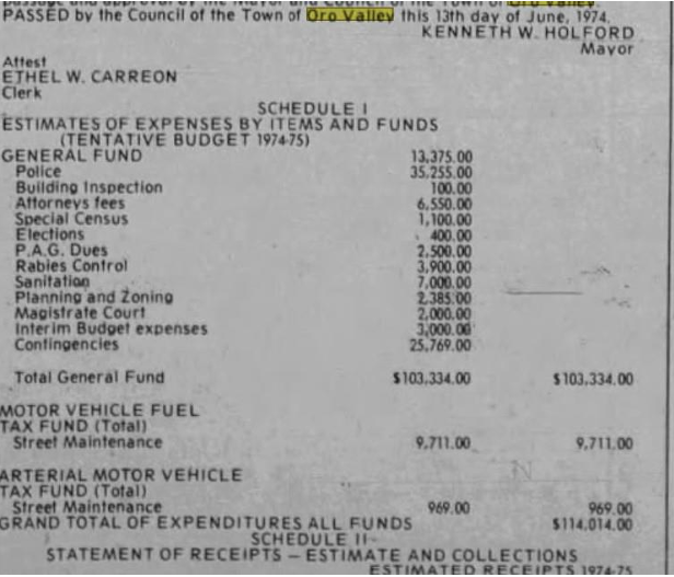
After the excitement of becoming a Town in April 1974, those who were then in charge of the Town of Oro Valley had time to sit down in May to figure out how that was going to work. They came up with a budget, and below is what our founding fathers decided on and passed in June 1974.
It’s hard to believe they thought they could run a town on $114,334 (about $429,444 in todays’ dollars) less money than the new shade ramada for the farmers’ market at Steam Pump Ranch will cost (for both amounts!), but that was 50 years ago. And yes, there were only about 1,200 residents in a 2.5 square mile area north of Hardy Road, east of La Canada, south of Lambert Lane, and a little bit east of Oracle Road. Not much ground to cover. But some residents thought the budget was too high, even back then.
Looking at the budget below, the biggest expense was for police. As we all know, Oro Valley has an A grade for safety rating, and we started out that way. Of course we are all grateful for the continuation of that service. However, did you know that the first police department was located out of a home on West Calle Concordia and our first police chief, Fred Roof, was actually a Rural Metro fireman (his first love)?
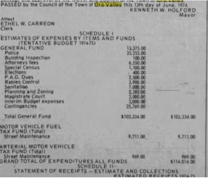
Town of Oro Valley 1974 First Budget
Due to an agreement with Rural Metro and Oro Valley, the department began with 2 1/2 full time equivalent employees covering the town 24 hours a day, seven days a week. The emphasis was on residential patrol and high visibility, and the police drove fire department green pickup trucks and a black and white pickup on loan to the Town from the fire department. As we all know, the current police department is very aware of speeding within our community, and that started out early, as well. Roof said that residents in the mid-1970s were demanding something be done to halt the sudden rash of traffic fatalities caused by drivers speeding through town and up and down Oracle Road. Driving 75 in a 45 mile an hour zone was not unusual, and people doing 55 and over in a 20 mile an hour zone was routine. There were also times that the police would be called to remove a stray cow from any of the neighborhood streets. That makes one wonder if that had anything to do with the $3,900 allotted for rabies control?
The other item that is interesting in this budget is over $25,000 for contingencies. It makes you think that the council just wasn’t sure what they were going to need, when they were going to need it, or how they were going to pay for it. At least they planned for those surprises, and aren’t we grateful that they did? Oro Valley is an incredible community, and we have these people to thank in our 50th year of celebration!
Read more about Oro Valley’s 50th Anniversary.
Written by Devon Sloan, July 2024
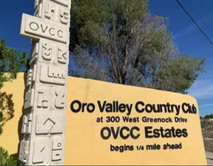
Imagine a 3,000+ square foot, four-bedroom, 3 bath home on one acre with mountain views, two indoor fireplaces, four car garage, with room for recreational vehicle parking, plus a pool and a spa in Oro Valley Country Club Estates. What a treasure! Well, you could have had that home in July 1974 for just $54,000! It had been built just 9 years before. Also, in July 1974 in the Oro Valley Townhouse development on Greenock Drive, a two bedroom, two bath, 2,757 square foot home was being sold for $34,750!
You must be asking ‘why would anyone leave those comfortable, magnificent homes in such a great location?’ Hopefully, it wasn’t because the owners were not in favor of the incorporation of Oro Valley and wanted to move out of the new town that was being formed, just 3 months after the incorporation was completed in April 1974. Looking back, that would have been a real mistake. Based on inflation over the past 50 years, the house would now be worth about $350,000, but with current real estate values, that home would sell for between $914,744 and $1,021,600! And the townhouse? Based on today’s dollars, the home is now worth $225,743 and based on real estate values $479,000. No matter where those homeowners moved to, it’s hard to believe they could have reaped such great rewards! Oro Valley truly is the Valley of Gold!
Happy Independence Day (and Incorporation Celebration) to All!
The turbulent path from April 1974 approval to the final 1975 decision that made the Town official. Written by Devon Sloan, August 2024
This year we are celebrating Oro Valley’s birth year month by month. Pima County approved the incorporation in April 1974, selected 5 people on the new Town Council (2 for incorporation, 2 against it, and one neutral), and ordered an election by the residents to be held in August 1974.
You would think that the new Town Council appointed in April would get to work and move forward to develop this new 2.5 square mile community with approximately 1,200 residents. Not so fast! Even after the approval, not all citizens of the new Town were convinced it was the right way to go.
For the August election, eleven people were on the ballot – 5 for incorporation, 5 against it, and one neutral. Voters were to select 5 to be on the Town Council until 1976, and those council members would select the Mayor. The Town Clerk at the time, said that about 632 people had registered to vote, and one of the candidates, then Mayor Kenneth Holford (the neutral candidate), said he expected a 70 – 80% turn out. He also stated that an election of an anti-incorporation slate would not automatically dissolve the Town, however he was less optimistic about the future of Oro Valley than he had been a month prior to this election.
At that time, the Town could be dis-incorporated if two thirds of registered voters signed a petition for dis-incorporation and presented it to the Board of Supervisors. The anti-incorporation candidates already had 387 signatures on their petition and needed only 35 more to accomplish their goal. At the end of the election period (going into October due to run-off elections), 4 of the 5 seats were then held by dis-incorporation candidates.
Throughout the time-period from August 1974 to August 1975, the Town citizens and Council had some contentious meetings about budget, sales taxes, services, recalls, zoning, and more. Even though Pima County had approved the municipality of Oro Valley in April 1974, it took until August 1975 for all the discussions to lead Pima County to turn down all petitions and finally make Oro Valley a town. The possibility of incorporation, which began as far back as 1968, was no longer an issue. Oro Valley was finally born.!
The town’s original seal was created in 1974 by Kevin Kriegh, son of Jim and Marjorie Kriegh. The current seal, adopted in 1990, was designed by local artist Matthew Moutafis. A handcrafted wooden version—made by former councilmember Steve Rennacker—can be seen in the Town Council Chambers.
From research by Henry Suozzi
Written by Devon Sloan, November 2024
“You owe us $12,000!” That’s what the Board of Supervisors of Pima County told the 7- month- old Town of Oro Valley in November 1974. Articles in November issues of The Tucson Citizen and the Arizona Daily Star noted that Oro Valley was under contract each quarter to pay Pima County for police protection, rabies control, and sewer and sanitation services.
The Town offered to repay the debt in bi-weekly $2,000 installments until the end of the year. The County did not accept that offer and voted to cancel the contract for services. Councilman A. Lauren Rhude noted that “the county can cancel the contract, but it cannot withdraw its services,” and was critical of the supervisors for not formally advising the Oro Valley Council of its intentions regarding the delinquent bill.
A staff member of the County Attorney’s office noted that failure to meet the payment schedule could result in stopping services to the Town, refusing to pay the Town tax money owed it, or sue the Town and force it to assess a property tax.
Because of this situation, Vice Mayor, Virgil B. Brandon, who had voted against incorporation, resigned his position and worked on gathering signatures on disincorporation petitions. A newcomer to Oro Valley from Phoenix, also against incorporation, was appointed to fill the position. Some residents went to court to eliminate the contract between the County and the Town.
You can breathe a sigh of relief (since you know all that controversy was for naught because we live in this great Town today). A month later, the Town started collecting sales tax and permit fees and did pay off the debt. Services were never stopped. The Town received the tax money the County owed. No property tax was initiated. Again, the struggle to keep Oro Valley a Town was avoided. Happy ending for all of us!

Written by Devon Sloan, October 2024
The newly incorporated Town of Oro Valley has its first Town Council meeting of elected officials in October 1974. During the planning stages, beginning in 1968, those who wanted the Town to be incorporated held meetings in people’s homes in Oro Valley Country Club Estates and Shadow Mountain Estates. Larger meetings were held at Canyon del Oro High School when interested parties wanted to attend.
At this first meeting, the Council voted to rent a two-bedroom apartment on Oracle Road as office space. Obviously, there weren’t many departments making up this new Town government, so this worked for a while. It became obvious that as the Town grew, so did the governing entities, and more space was needed.
Two years later, the Town Hall was moved to a building on Calle Concordia, and Town residents were asked for donations of $10.00 per household to help pay for this purchase! The Town actually purchased the property in 1979. The second Town Hall on Calle Concordia, now houses the Town’s Storm Water Utility and Public Works Departments.
But as you know, the Town continued to grow and so did the staff and departments who serviced the community. More space was needed, and in 1988, Oro Valley purchased the land on which the current Town Hall is located. This new Town Hall was opened in 1991.

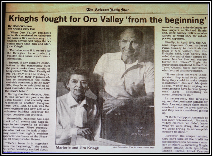
The following article is from the Oro Valley Historical Heritage Guide, April 2009 – by Marjorie Kriegh, wife of Jim Kriegh and first Town Historian for the Town of Oro Valley.
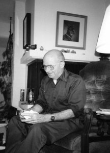
Jim Kriegh Planning for the Future in his Living Room
It is fact that the Town of Oro Valley has been happily incorporated since April 1974. But, perhaps, you have wondered how and why the Town of Oro Valley came to be.
Our story began long ago, way back in 1968. Tucson Mayor “Gentleman” Jim Corbett made a statement, which, to some area residents could be likened to the “shot heard round the world”. Well, ‘round Tucson, anyway. Mayor Corbett said that they (the areas around Tucson) will be taken in (to Tucson’s city limits) “kicking, stamping and screaming, if necessary”. The City of Tucson’s political climate, as it was at that time, was not to many people’s likings and many, many people living outside Tucson’s corporate limits wished to remain so. Some concerned citizens began to look at the feasibility of forming their own town in order to avoid being “absorbed” by the City of Tucson.
The State of Arizona, however, had done its part to discourage incorporation of areas on the “outskirts” of larger municipalities. A ruling came down from the legislature which stipulated that an area proposed for incorporation must have at least 500 inhabitants who all had to exhibit common goals and objectives. Additionally, to protect the larger cities, an area proposed for incorporation had to be farther than six miles from another incorporated city’s boundaries. If the proposed boundaries were not six miles apart, then permission by the incorporated city must be given. Larger cities and towns lobbied long and hard for these incorporation rulings because they did not wish to be hemmed in by a proliferation of “bedroom communities”; to avoid competition.
Some residents northwest of Tucson were undaunted by these rulings. With the competent legal advice of Mr. Ellsworth Triplett, for whom I served as legal secretary at the time, interested people began to organize. These people came from, not only the area later to become known as Oro Valley, but also, from the Catalina Foothills area.
There were obstacles to overcome. The “six-mile” rule made incorporation of the Catalina Foothills area impossible, but, as Mr. Triplett advised, the outlying area which included the Oro Valley Country Club Estates and the Highlands Mobile Home Park, could conceivably be incorporated since the area was six miles distant from the City of Tucson limits. (Later, the Highlands Mobile Home Park was dropped from the incorporation effort because less than 50% of the people favored the incorporation.) At this time, the proposed Town was to be named, The Town of Palo Verde.”
Because the Oro Valley Country Club Estates, under the direction of Mr. Robert Daly, President of the Homeowner’s Association, was undertaking street improvement, interest in the incorporation effort waned for a time, but was renewed when Mr. E. S. (Steve) Engle, the new Oro Valley Homeowner’s President became interested. Together with my husband, Jim Kriegh, they gathered citizen support from all areas proposed for incorporation, including Shadow Mountain Estates East and West, Campo Bello Estates, Linda Vista Citrus Tracts, and Oro Valley Country Club Estates.
Citizens from all these areas worked long and hard for many years, the culmination of their efforts being the filing of a petition for the incorporation of the Town of Oro Valley with the Pima County Board of Supervisors. As may have been suspected this petition was promptly rejected by the Board, leading to a four-year court battle which ended in the Arizona Supreme Court. The decision handed down by the Supreme Court directed the Pima County Board of Supervisors to incorporate our tiny 2.5 square mile Town of Oro Valley.
This decision signified the birth of the Town of Oro Valley on April 15, 1974, and the beginning of a Town which, it is hoped, all citizens may be proud of today.
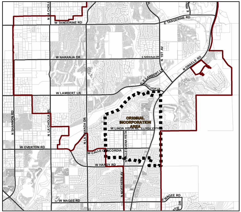
Map of Original Incorporation Area of Oro Valley
The Arizona Daily Star article is from April 26, 1984.
Marjorie Kriegh: A Woman Who Helped Build Oro Valley
OV Fought to Become, Then to Stay, a Town, by Dave Perry (featuring an interview with Twink Monrad)
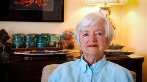
Twink Monrad, 2024
Also by Dave Perry: The Story of How the Loop Came to Be. Thank you, Dave, for all of your contributions to Oro Valley!
Dave Perry
Historian and former OVHS President Jim Williams leads this panel session that brings together Dave Perry, Kathi Cuvelier, and Spencer Elliott to reflect on how Oro Valley has evolved over the past several decades.
Launch the video on our YouTube channel. It can also be accessed on the Town of Oro Valley’s YouTube channel.
Devon Sloan: You’re here for the part two of Oro Valley: the first 50 years. Last month we had a great presentation that Jim Williams gave us about the whole book. Now we’re going to pick out some certain parts of it. Oro Valley Historical Society is really honored to have Jim Williams as a lifetime member, a past president, and our current historian. After you sit through today, which is going to be very interesting, you’ll know why he is our historian. So, I’m going to introduce Jim Williams to you and he will introduce the panel, and I know you all will enjoy the afternoon. Thank you again for coming.
Jim Williams: We have a series of programs planned that are going to be panel discussions. The one next month—and there are a few handouts in the back—but the one on March 11th will be three mayors: the current mayor and two former mayors, Mayor Hiremath and Mayor Loomis. We’ll have a discussion about change that they’ve seen in the community. Then April 8th we’re going to have three people who were involved in the original incorporation period, and they’ll be speaking in a panel like this. So, I hope you can attend as many of those as possible.

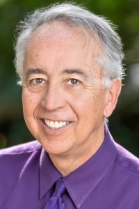
Jim Williams, Author of Oro Valley, The First Fifty Years and 2025 winner of a national award from the American Association of State and Local History.
Today we’re going to be talking about how the community has changed in the 50 years since that time. None of the people here go back a full 50 years, but they have a wealth of experience in the town. On my far right, Dave Perry was the editor of the Explorer in the early 2000s. He’s been the president and CEO of the Chamber of Commerce, and he’s now again working as a newspaper reporter.
Next, Kathy Cuvelier was a town employee back in 1980 and she retired in 2011. She served as the town clerk for most of that time. And Spencer Elliott, on my immediate right, has been a resident since 1985 and he’s been involved in many political campaigns and activities all through this period. These people have seen a lot of what’s been going on over the last 30 or 35 years of Oro Valley.
So, my first question—and I’m going to ask Spencer Elliott to answer this first—is why did you move here, or why did you begin to work here, in the case of Kathy Cuvelier? When and why and how did you get here?
Spencer Elliot: Well, we moved here, really my wife and I, for a job change. I worked for what was then called Air Research Manufacturing Company of California, which ultimately many of you who are newer in the town only know as Honeywell up here on the northwest side now.
When it started, we were down by the airport on Elvira Street. That job change was a kind of major life change. We lived in northern Colorado at the time, and I had two job offers—one with Ball Brothers in Boulder and the other with their research here in the Tucson area.
My wife was smart enough to say the company is going to move you, so why don’t you go where people retire? Then when you get ready to retire you don’t have to move. So that’s why I let her make a lot of the decisions in my family.
Jim Williams: Go ahead, Kathy Cuvelier.
Kathy Cuvelier: Okay, well I applied for the deputy clerk position actually prior to 1980, and my interview was a little interesting to start. I was moving into a new apartment and I had a friend who had another friend who helped us move. She started asking me questions about my prior experience and so forth. I’m answering the questions, and then she said, “Would you like to apply for the deputy clerk position at the Town of Oro Valley? You would meet with the mayor and council and talk with them.” So, I did that and I was hired January 2nd of 1980 as Deputy Town Clerk. I was fortunate enough, and that just began a really wonderful change in my life and a wonderful career.
Jim Williams: Great, thank you.
Dave Perry: Thank you all for being here. It’s a pleasure to be with you. My name is Dave Perry and Lisa, and I moved to Oro Valley December 1st of 2007, so I’m much more recent to the community than my colleagues to the left. I came to be the publisher and editor of the Explorer newspaper. The paper had been sold to a publisher from Colorado, and we moved from Scottsdale to Oro Valley. We rented a house on the north end of Oro Valley, if you know High Mountain View Place. When we first came here my commute went down Oracle Road, and Oro Valley Marketplace was being scraped and built at the time that we moved to Oro Valley.
I worked at the Explorer three years and then we parted ways. Then I ran the Chamber of Commerce in Oro Valley for 11 and a half years. We love living here. We think it’s a great place and I hope to spend the rest of my days here.
Jim Williams: Great. The question that I plan to ask for almost all of these is this: because so many of us have come at different times here, what did this community look like to you when you moved here, and how different was it then than today? Spencer Elliott, why don’t you start first, because you have some of the earliest experience.
Spencer Elliott: Well, it looked a lot different, that’s for sure. There were less than 3,000 people in the town. One of the first political activities that my wife and I ever got ourselves involved with was the annexation of Rancho Vistoso, which was not in Oro Valley at the time. Oro Valley was a very small town at that point.
One of the people involved was Katy Engle, if any of you remember that name. Katy was the wife of Mayor Steve Engle, who was the mayor for the longest time here in Oro Valley. I think he was the third mayor, if I’m correct. She came by one time with a petition and said, “Do you think that the people in Rancho Vistoso should have the right to vote as to whether they want to be in the town or not?”
Well, yeah. It seems like people ought to be able to make their own decisions about whether they want to be incorporated or not. So we signed the petition, and from there it just kind of mushroomed into a whole bunch of other things. From the early days—and I don’t have all the stories in here, and Jim Williams probably has them in his book if he’s talked to the people who have been in town longer than I have—there was the notorious Oro Valley speed trap story as to how that came about.
Many of the town employees, after every rain when the streets would fill up with sand, would go out with pickup trucks and shovels. Instead of coming into the town that day they would shovel sand out of the streets, because it was the only street cleanup that we had in the town at that particular time. So I don’t know if that gets an answer to everything you’re looking for, Jim.
Jim Williams: What were you referring to as far as the speed trap?
Spencer Elliott: Well, the speed trap really was that we didn’t have a lot of police at the time. In fact, kind of a funny story: our neighbor was a man named John Dillon. He and his wife Hope were from Kansas. They knew each other back in their high school days and eventually married different people and moved their own ways. Then both lost spouses, so they got back together.
When the town was looking to incorporate, it needed to have a police official. I think it might have been Steve Engle at the time, but it might have been somebody—one of the mayors before—who asked John if he would be willing to take on that job, because they were looking for someone to be the police official to sign the incorporation papers. He thought about it for a little bit and decided, well, it’s kind of natural. If you’re from Kansas and your last name is Dillon, you should be calledMarshal Dillon. So that was our first police official that came to the town.
Jim Williams: Okay, go ahead Kathy.
Kathy Cuvelier: Okay, thank you. I’ll just continue on. So when I started working in 1980, I was the deputy town clerk, but in March of 1983 I was appointed as the town clerk for the town. Just to give you a little bit about the demographics of the area: Oro Valley was still four square miles, and Oracle Road was still a two-lane highway. The official 1980 census at that time was 1,489 for population.
I worked at the Calle Concordia location, 680 West Calle Concordia. At that time that was the official town hall, and that included everything needed there. The two back bedrooms—it was a former house—were the police department, the chief’s office, and the squad room. Then the dining room was the council chambers, and the living room was all the administrative services. So everything you needed, you came to 680 West Calle Concordia to get help. I was the tenth employee to be hired, which meant that we could qualify now for group insurance and get a special rate on insurance for town employees.
Also, around the area, there was only—let’s see—to the east of the town hall was Canyon del Oro High School that had been there since the early ’60s. Then Linda Vista Citrus Tracts were to the west of the town hall. There was a farmer, Orval Shields, who had a peach orchard and did quite well selling peaches there. Also, there was Shadow Mountain Estates and Oro Valley Estates Country Club in that area. Then there was a 7-Eleven at Hardy and Oracle, which is now the Kathy Sew & Vacuum building. Let’s see—that was about it. Oro Valley was very rural in its nature, and at that time anything north of Calle Concordia was just desert, and that was about it. So I’ve seen a lot of changes since that time.
Jim Williams: It might have been that the population of cattle was higher than the number of people.
Kathy Cuvelier: Could have been at that point. Yes, because the Rancho Vistoso area used to be an area for cattle to graze many years ago before the land swap.
Jim Williams: So, Dave, you came in in the mid to late ’90s. What do you see as the difference of then versus now?
Dave Perry: Well, I came in ’07, and we saw the—remember, I ran a business and community organization for a number of years, and I paid a lot of attention to apartment communities. We saw three major apartment communities come into Oracle Road. One thing I have really been astonished by, frankly, is the growth in senior living—the senior care communities. Today I drove past La Posada at Pusch Ridge down off of First Avenue, which is an amazing facility and large.
Dave Perry
I remember a friend of mine, Lynette Jaramillo—the late Lynette—who ran Casa de la Luz Hospice and founded it. One time I said to her, “What’s all this senior living?” She said, “Remember that we have low taxes, we have a great place to live, we’re clean, we’re safe, and we’ve got weather that people care about. So that industry is always going to be in this community, and it’s always going to grow.” And I accept that, of course, and recognize that.
When we came here, La Cañada was still two lanes, and there was the big fight on the south end of La Cañada north of Ina about what kind of road was going to be put in—what sort of walls and things like that. It was a very contentious subject. Now we look at it and say, “Well, it’s just how it is.”
In those days, by the way, Oracle Road was just as bumpy as I remembered it until we finally got it resurfaced here several years ago. But the growth piece has been consistent in my time here. I give credit to mayors and councils that the quality of growth in this community has been exceptional. Jim Williams points that out in his book—that the look of Oro Valley is without peer, frankly, in Southern Arizona. I lived in Scottsdale for seven months when I first moved to Arizona. Scottsdale is a nice place, but it’s not Oro Valley.
Jim Williams: Dave Perry, you kind of got into that question. My next question: why have so many people moved here? The weather is great, the mountains are great, but of course the whole area has the weather and the mountains—that’s not just ours. — So, the question would be: how did we grow from 800 or 900 people to 47,000? Spencer Elliott, what do you think?
Spencer Elliott: Well, I know when we first came, part of the reason that people wanted to live here was safety. I think we were either the first or the second safest town in the U.S. at that time in the mid-1980s. Again, all the things that have been mentioned—it’s a nice place to live. My reason for moving here was my job changed and effectively required that I move here. Psychologically I can’t explain why other people do, but I think they see the same sorts of things that we found here.
We found it really kind of interesting talking to people over the 30-something years. People either love this part of the world or they hate this part of the world. They don’t seem to be neutral about it. I don’t really understand why that is, but my education was not in psychology—it was engineering—so that’s beyond me to answer.
Kathy Cuvelier: Well, I think you both have mentioned a lot of the reasons why people come to Oro Valley. Definitely the lifestyle. Public safety is so important, especially these days. You can come into Oro Valley and you’re not going to have issues with major crime. You feel safe, and the residents love that feeling of safety. Ever since I was with the town, the police department has had the dark-house program. If you’re going on vacation, you can register with the police department and they’ll check your house while you’re gone. That’s a level of safety for the residents.
Oro Valley—we didn’t always—but we now have many parks and amenities for families. This is a great place for families to live. Of course, when Sun City Vistoso came into Oro Valley, we have a nice retirement area as well. We used to have the reputation as a bedroom community, but that has totally changed. There are a lot of different things now for all age levels to enjoy.
Jim Williams: Great. I gave the three people the questions in advance so they could think about them. One question I asked was: what individuals do you think have had the greatest impact on the town? Maybe pick just one person and talk about how they had that impact. Dave, do you want to start?
Dave Perry: Sure. I’m going to bring up somebody you may not think about so much, and that’s Dr. Tom Grogan. Tom is the founder of Ventana. He brought Ventana to Oro Valley. Paul, you remember when that was—mid-’80s I believe. Dr. Grogan and the people at Ventana—and now Roche—they are a world-class company that does remarkable things in our community. By the way, they employ 1,800 people in Oro Valley. It’s the biggest bioscience company in Southern Arizona by a number of folds. They bring vitality to this place. They bring high education, high achievement, and they bring a ton of jobs. They just bought the old Sanofi building up in Innovation Park to further expand their footprint in our community.
I give Dr. Grogan—who is a wonderful man—a lot of credit. If you ever get a chance to read his book Chasing the Invisible, it’s terrific. His decisions and the decisions of others at Ventana years ago have had a lot of influence on our community.
Spencer Elliott: I’m trying to narrow this down to one. Yeah, it’s hard—one or two. Well, this could sound somewhat biased in some ways, but I’m going to have to say that my wife was. For really two reasons. One was when we came to town and first got into any of the political atmosphere that was going on in Oro Valley. Every development that came into the town had to be approved in all its gory detail, all the way down to what the roadbeds were supposed to look like, by the town council.
It was—I know my wife asked the question when she was on the council at the time—“Why do we have to go and do all this kind of stuff? Can’t we just adopt standards that already exist, since we don’t seem to have one for ourselves?” There was a lot of pushbacks about that, but eventually she was able to facilitate a change and we adopted the Pima County standards. Since that time the town, of course, will modify where needed to meet whatever specific issues go on with the town.
Prior to that, the council meetings were mostly taken up with more civil engineering tasks than any governance sort of activity. The other thing I want to say is that I think she had a big influence on—because I remember her saying, “I’ve never signed a check that big,” when the town bought the Metro Water Company so that the town could control its own water destiny instead of allowing Tucson Water to buy it.
Jim Williams: You mean—this is your wife Lee, or was that someone else?
Spencer Elliott: No, that was Lee that did that. Since you mentioned Lee, that was always an interesting thing too. Sometimes you’ll see her name written with quotes around Lee, but that really was her middle name. Her first name was Lanetta, and everybody thought Lee was a diminutive of that, but no.
The funny story in the family—not to make this too long—was that her mother wanted to have two boys and a girl. Lee came along first, and she didn’t have any boys’ names picked out, so she told her husband to go name her. He didn’t have any girls’ names picked out either, so he went down and named her after two ex-girlfriends.
Kathy Cuvelier: Oh my God. Spencer Elliott: I’m sure that went for years in the family, but that’s some of the history of what’s happened.
Jim Williams: Yeah, thank you.
Kathy Cuvelier: Well, as you say, there are so many that I can think of—so many names over the years. But I’ve got to start with James D. Kriegh, who was the original founder of the town.
In 1968 he saw and heard that the City of Tucson wanted to annex from mountain to mountain. Also, I think there was a planned Pima County substation where the park—where James D. Kriegh Park is now. He decided that it was time for Oro Valley to shape its own destiny.
So, he contacted Steve Engle, who was also one of the original incorporators, and the two of them worked together to incorporate Oro Valley. It took until 1974 to incorporate the town, but as you probably know the story—there were a lot of legal issues and battles (search this page for more stories about that!) to try to become incorporated. But it did happen, and those two, along with so many volunteers and others, helped and had this vision of what they wanted Oro Valley to be.
Jim Williams: I would chime in on that as a historian. I think very important were Jim Kriegh and Marjorie Kriegh because they saved a huge amount of documentation on the early history of the town—not just the incorporation but the first seven or ten or twelve years of the town—which would have all disappeared had they not saved that material.
Kathy Cuvelier: Yes, it’s been very important. Absolutely, I would agree with that. Jim Kriegh’s wife Marjorie, as you say, she was the town’s first historian. So yes, I would agree with that.
Jim Williams: Okay, we have to stop for a second. Okay, very good. Next question: what do you think have been some of Oro Valley’s government successes over the years? I know we’ve alluded to a few things like the police and other things. What do you think are really some of the things that the government has done right here? Dave Perry, how about you start with that one?
Dave Perry: Sure. One subject that I think is under-told in this community is our water utility and how—and I don’t have the specific statistics in front of me—but I believe that Oro Valley uses less groundwater now than it did in 2006 or 2007, even though our population has grown. We’ve diversified water supply. We now have Central Arizona Project water that enters into our supply. Of course, we’ve brought reclaimed water to golf courses and park spaces. It’s a remarkable story.
Everybody frets about water, but our community, thanks to leadership, is pretty well positioned to get through all this and, in fact, lead in terms of the way that we use that precious resource and how we might be able to responsibly grow with it as well.
Kathy Cuvelier: Well, I would say that when the town incorporated it did so with the promise that they would not enact a local property tax. They wanted to control the town’s growth and have strong police protection, good roads, and listen to their residents. At that time they had a vision of wanting Oro Valley to look like a Paradise Valley or a Scottsdale.
Also, the town has always been fiscally responsible and has always strived to maintain a balance between what the residents want and what the developers want, while also having to live within Arizona state law to honor the property rights of the developers that were developing in the town. I think they’ve done a pretty good job through the years of trying to do that. It’s not easy to do.
Spencer Elliott: Well, the water definitely is one of them, and I have to echo what has already been said by my colleagues here. I don’t know if there’s really a lot that I can add to that as successes.
Possibly thinking about how the council has been restructured over the years might be considered a success because it’s opened the town up more to a democratic possibility than was there before. When we first came, the council members were all elected by the people in the town, but the mayor was selected to be the chairman of the council and they chose the mayor amongst themselves. The people didn’t have any say as to who was going to be the mayor. It was necessary—somebody had to sign all the paperwork officially for the town—so somebody had to be in charge, and that’s how they selected that.
One of the big successes is the recognition that we needed to make this change here in the town. I think it’s for the better. We’ve expanded the council and now we have direct election, so I think it’s a more democratic process now than it was in the early days.
Jim Williams: Plus the size of the council was expanded too—from five to seven. What sort of things might the town have done differently or better, in your view? Who wants to go?
Kathy Cuvelier: I’ll go first, I’ll go first. I was just going to say I’m not sure that I’m qualified to answer that question, so I don’t really have an opinion on that, if that’s okay.
Jim Williams: Okay, that’s fine, sure. Dave Perry, any ideas?
Dave Perry: Well, again my tenure here is shorter duration. I look at the Marketplace and I see the incentives that were approved by the voters, and you know the Marketplace has struggled for so many reasons. Now I think we’ve found a way forward to create apartments there, create more of the mixed-use kind of redevelopment, honestly, of the Marketplace.
When I first came to Oro Valley, the late great Bill Adler was prominent in our community, and he’s somebody that should be mentioned as well. Bill didn’t like the whole concept of mixed use, as I recall. But that’s changed, and I think the modern council and others have recognized that in order for a place like the Marketplace to succeed, we have to do something different than what was envisioned originally. I think we’re heading in the right direction there. Looks good.
Jim Williams: Great, thank you. Citizen involvement—there have been many contentious meetings in the history of this town from the very beginning. My question is: has that been a good or a bad thing, citizen involvement in—and particularly most commonly related to land use decisions? Spencer?
Spencer Elliott: Well, I think you do have to have the citizens involved in this. Otherwise, they’re sitting out there and they’re just kind of grumbling. If it does make for contentious meetings—I know there were many times, and Kathy you can attest to this too—how many hours the council meetings went on, giving everyone an opportunity to speak.
Then of course as the town population grew and the town hall got bigger and more seats went in, I think it was Steve Engle who brought in an egg timer and said, “You have three minutes to make your point to the council, and when the sand runs out you have to sit down.” That kind of moved things along a bit. I’m not saying it sped things up too much, because there were still an awful lot of speakers. But I think without citizen involvement you don’t really have a town.
Kathy Cuvelier: Very true. The egg timer was before we had the limit timer, which is the electronic little thing that tracks your time. Citizen involvement has always been very important to Oro Valley.
It’s impacted the town in a number of ways in the government. We have so many volunteers that give of their time and talents, many of them just out of the goodness of their heart because they care for the community. They have helped this community for the past fifty years. Without citizen involvement we wouldn’t be the community that we are today.
Just like the Oro Valley Historical Society doing what you’re doing—you’re not a paid committee, you’re just doing it because you love your community and want to preserve the history. Thank you.
Dave Perry: I might have a longer answer than my colleagues here. I spent twenty-eight years as a small-town newspaper reporter, editor, and publisher in Wyoming, and I’ve been to a lot of government meetings over the years—tons of them. When I first came to the Explorer we had a very rocky relationship with Marana. So, I said, “Okay, I’m going to try to fix that.” I met with the mayor and town managers and developed relationships there, and I went to Marana town council meetings for three years.
There were many times when I was one of a handful of people in the audience. There just was not the sort of participation that we see in this community. Even in Wyoming, when the issue was super inflammatory, sure there were a ton of people there—but not on a consistent basis as we’ve seen in Oro Valley. Now it’s changing a little bit because of the pandemic and now we’ve got technology where people can plug in from home and participate in council meetings. But I’ve never seen a place where the citizens were this involved in the day-to-day decisions that go on.
Remember my context—I ran a business organization. I know those developers, and they used to complain. It’s better, it’s gotten better over the years than it was. I’m not a subscriber to the phrase “time is money.” I don’t equate those two things. But I do know that in business, time costs money. The longer things go on in the decision-making process—however legitimate and valid it may be—businesspeople see that as a negative.
The other side of that coin, of course, is that when they get into business in Oro Valley and they’ve gone through all the public processes, I walk in and say, “How’s business?” Almost invariably they say it’s great, because they now have access to this wonderful market. I draw the market lines by the way—I go to Dove Mountain, I go to SaddleBrooke and SaddleBrooke Ranch. I think Oro Valley needs to recognize that our public participation toward business yields a certain result. But the market area is bigger than the 50,000 of us who reside here. It’s really a unique thing. I’ve said to developers over the years, “I know you don’t like it, but that’s how it is. It’s not going to change in my lifetime.” This community will always show up and express itself.
Jim Williams: That’s something that goes back to the very beginning. The contentious meetings really went on for a long time and certainly increased in the 1980s when the town began to expand. My next question is about annexation.
The town has gone from 2.5 square miles to approximately 37 square miles in size. Why was that done, and is it a good or a bad thing in your view? Spencer?
Spencer Elliott: Well, one of the contentious annexations I remember was when it was after Rancho Vistoso was annexed and the original town of Oro Valley around the Country Club area was already in place. They were connected by a little strip of Oracle Road. And then there was this large peninsula of county land that was stuck right in the middle between the two of them, and it was surrounded on three sides by the town. Ultimately, I think that’s how the annexation came about because it was being surrounded as it was it was almost impossible for it not to be annexed in. But there were a lot of fights over what was happening with that. Annexation seems to be one of those things that bring out the good and the bad in people and what do they consider to be the most important things in their lives and who’s to say what any one of us are going to say is the thing that we considered to be most important at the moment.
Kathy Cuvelier: Well I look at annex from a ministerial right point of view with my job and that was one of the big things that I helped with were with town annexations. As you can see or have heard we have grown quite a bit so, the way that I the town looked at it is that we had the ability to grow the size of the land size, population, and it added revenue for the town to provide services to its residents. And then also – it may still be the policy but at the time annexation policy was to annex land that was not developed so that the developers in the town officials could work together to develop the property in accordance with Oro Valley standards. The town was very fortunate we had several annexations that were conducted in that manner, so I think it’s been a really good thing for the town. There’s no way we would have survived on what, two and a half miles, so I think the town is beautiful and how it’s developed and trying to develop it as close to the needs of the community as the elected officials can make it.
Jim Williams: A number of you have been here for many years. How would you assess the way the political climate has changed in this town over the years? Maybe Kathy you don’t want to deal with that because you were kind of in the middle.
Kathy Cuvelier: Yeah, since I’ve been gone for 13 years, it might be kind of hard for me to say other than the town did experience a lot of growing pains as a small town.
Jim Williams: I know you were the one that with that quote was yours originally in the newspaper.
Kathy Cuvelier: Oh, okay yes. And we had many recall elections as some of you may remember from 1993 to 2000 and that was a hard time in the clerk’s office, but we got through it. I think the reason for that is that mainly people, of course, were not happy with decisions of the elected officials or they didn’t like changes in the land use that council members had made. That’s about all I can say for that.
Jim Williams: Spencer, do you see—you and your wife were involved in elections here in the early 1990s and you’ve seen what’s going on since—do you see a change here?
Spencer Elliott: Well, I have to agree with Kathy and there were an awful lot of recalls. Lee was subject to one of them at one point and what else can one say? The climate really has changed to an extent I think for the better but at the same time it seems like it has picked up less of what we are doing here in the town for our own good and more of what the national political climate has in the way of influencing us and a way to kind of separate what’s happening from what is the thing that’s good for the town of Oro Valley from the what’s happening in the national scene which is entirely different decision in my mind to make.
Kathy Cuvelier: I was just going to say, you know, Oro Valley is known as a general law town and it’s nonpartisan, so people always want to take political sides. But in Oro Valley that it’s a nice thing that the council members don’t have to worry about is they’re there for the community, not for what political party they belong to. I think that’s a good thing about Oro Valley.
Dave Perry: I go to a lot of meetings to this day and I’ve watched some of the behaviors at neighborhood meetings, planning and zoning about apartments, you know, we’re having these conversations about apartments in our community right now and I’m not weighing in on right or wrong, good or bad, but I think that the national tone does have a tendency to drift down. If you will, that we sometimes lose our civility and we lose our obligation frankly to one another to listen and to be open to compromise and not to question motivation. I see a lot of times I’ve heard people say, “Well, you don’t care about Oro Valley.” Oh, baloney, everybody cares about Oro Valley; we just may not agree on how the community should proceed moving forward and I think we got to be careful about that, that we not become that bitter, angry, frankly sometimes intimidating environment for the minority voice. We got to be careful about that because we got so many positives in this community. Can we be respectful in our differences? Can we agree to disagree? And I’ve been reading too much on that subject lately and I think it’s comparative, especially in the national climate with a presidential election that’s going to be the ugliest thing any of us have seen in our lifetime politically. So, let’s do our best here.
Jim Williams: Thank you. Question about the future. What policies would you like to see Oro Valley pursue in the future? You know, if you had your wish list of things that the town could do, what would they be?
Spencer Elliott: Sure. Thinking about this question, one of the things that I really appreciate was the town working with the private organization to acquire the abandoned golf course and turning it into a public open space for the citizens of the community. So, I would like to see more of that kind of activity when such opportunities present itself, that is, is there a way for the town to actually do this so that it benefits all of us here in the town.
Kathy Cuvelier: And, you know, I’m retired and I don’t live in the town, so I’ll pass on this question.
Dave Perry: Let me—I’ve got two points. Spencer Elliott, I appreciate your comment about Vistoso Trails. I rode my bicycle through there today. I love riding my bike there. I saw a big group of burrowers out there this morning. I’ve seen deer, I’ve seen all kinds of stuff. And the challenge for mayor and council is how do you pay for that? You know, it needs six figures of investment every year simply to maintain it, to improve some safety considerations. It’s a jewel, but how do we pay for that? And I think we’ve got to keep that in mind.
But that’s not a policy for the future; it’s just the thought that occurs now. The one thing I—and the mayor and I, when I was around the chamber, we used to joke about how little water we used in our households every month. Our goal—Lisa and I, the kids are old and away—we try to use less than 100 gallons a day and we’re succeeding when it rains right now. And I play around with water harvesting. I got wheelbarrows and buckets and I’m trying to keep as much water in my own landscape.
The other day, when it was beautiful rain, the storm drain goes right by our house and goes down into the Highlands Wash which is behind us, and I just watched the water pour into the Highlands Wash and I said, I wonder if we could catch some of that at street level and maybe move it onto somebody’s oleanders or whatever they might be. And I also wondered about stilling some of the water in the wash so that maybe we had bigger mesquites down there, maybe richer wildlife habitat that resulted from a little bit of conservative water management that way. And I believe this sincerely: I think Oro Valley could lead the southwest in how we deal with our water resources to include what falls from the sky.
Jim Williams: Thank you. This is now the time for the audience. Do you have a question you’d like to ask the group? And if so, please stand so we can hear it.
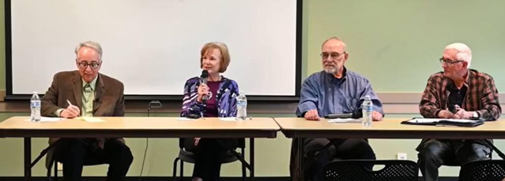
How Oro Valley Has Changed Panel Discussion with Jim Willliams, Dave Perry, Kathi Cuvelier, and Spencer Elliott
Audience member 1: Two things. I don’t think Spencer ever answered the question about the speed trap. If we ever got back to that, how we got that reputation early on. Could you talk a little bit about how the vote went to annex Rancho Vistoso?
Jim Williams: All right, so the question is a little bit about the speed trap back in the early 90s and the annexation of Rancho Vistoso.
Spencer Elliott: Well, I don’t know what the vote was on the annexation of Rancho Vistoso, so that’s just going to be in the public record someplace as to how that one went. But the origin of the speed trap reputation was as—say there wasn’t any service here in the town, so we needed to have a police force. And we had a citizen volunteer who had a pickup truck, and they gave him a, you know, what the bubble gum machines are that the cops will sometimes take out and they’ll stick on top of the car. He had one of those, and if he saw somebody that he thought was driving too fast on Oracle Road, he’d put that on and chase him down Oracle Road and give him a ticket. And, who knows what his speedometer was actually calibrated to be, but if he thought they were going faster than he thought they should, they got a ticket for speeding. And that’s how our reputation came about.
And then I know Werner Wolff, who was the police chief when we first came here, he fought for years to try to overcome that. He told us one time—and I think you just saw an article in the paper—about 5 miles an hour over the posted speed limit and what happens with that. Werner said he told his people that if they’re 5 miles an hour or less over the posted speed limit, do not pull them over and give them a ticket.
Jim Williams: Yeah, the town had quite a reputation partly because they had a fairly aggressive magistrate that was also dealing with that issue and assigning fines, etc. But that goes back to the late 80s, very early 90s.
Kathy Cuvelier: I just wanted to clarify I think that Marshall Dylan—I think that goes back to the 70s, before I was with the town. And when I came to the town, we actually had a former police chief sitting in the audience. Maybe he doesn’t want us to know that, but I think just because Oro Valley was so small and they had time to enforce the law.
Yes, but I think with Werner Wolff, it was supposed to be don’t ticket nine or below unless there’s something else going on besides speeding. But yeah, we have fought that reputation all the way through the years.
Jim Williams: Yeah, it’s pretty well gone now. How many people here have ever heard that before? Well, some.
Audience member 2: Okay, I was told, “Go up Oracle in Oro Valley, be sure you watch your speed.”
Jim Williams: Right, that was sort of the peak of that kind of talk about town. Other questions, please stand.
Audience member 3: Will you address the history of Catalina State Park, please?
Dave Perry: Jim, you’re the guy to answer that question.
Jim Williams: That’s a long talk, but there was a group of about 10 environmental activists. None of them lived in Oro Valley—Oro Valley didn’t exist when they got started. There was a plan announced to build 6,800 homes on that property and they were all pretty much members of the Sierra Club. They met at a Sierra Club meeting and said, “We’re going to fight this.” They worked over a 12-year period to convince the county and the state to obtain that land. The county bought about one-third of the current park and the state traded land in Rancho Vistoso for the other land, the other two-thirds of it. That’s kind of in a nutshell how it came about.
I’m part of a group now that’s actually looking and trying to get a plaque put in Catalina State Park to recognize those people and what they did because, again, it’s one of those things that’s lost in the past now. All the people who were involved—well, 99% of them have passed away, and unfortunately, I did not get a chance to interview any of them. Other questions?
Audience member 4: The years of the pardon, when was it?
Jim Williams: The fight was from 1970 till it was created in 1982. A big part of it was the fact that Governor Babbitt took office because the previous governor died in office, and the previous governor was against it, and Babbitt was totally for it. That was a big turning point in getting it pushed at the state level.
Audience member 5: That would have been a good time to plug your book.
Jim Williams: Oh yeah, speaks to—there’s a whole chapter on that that goes over in detail. If you want to read a shorter summary, there’s a two- or three-page summary on the Catalina State Park website, but mine’s in a lot more detail. Other comments or questions?
Dave Perry: Can I comment about something? You brought up the speeding issue. Once I was in a chamber meeting, Chief Sharp, who served us for 20 years, somebody was complaining about his enforcement of the speed limit, and he said, “If you don’t want me to enforce the speed limit laws, which other laws would you like me to ignore?” And when he retired, I was asked to speak, and I said, “The truth is, it gets into your psyche that you don’t speed here because you think you might get pulled over. And as I get older, I shouldn’t drive fast anyway. But the truth is, we’re safer as a result. The incidence of property damage and physical injury in accidents in our community is lower than it is in places where people are speeding.” So, one more great thing about Oro Valley: we’re subconsciously aware of the speed limit.
Jim Williams: So, do any of the panelists have any final comments?
Kathy Cuvelier: I just wanted to thank you for having me here. I have very fond memories and a wonderful career with the town of Oro Valley for 30 years. And although I don’t live in the town limits, I still feel like this is my town. So yeah, thank you, enjoy meeting all of you.
Spencer Elliott: I’ll echo that. I would just like to add that looking at what’s happening with the present political climate, I would encourage all of you to talk to your children and grandchildren about civic duty. Many in the town here, as we kind of grew up with the town as it was expanding, recognize that if the town was going to go any place, we had to be involved in doing this. But I know some of the young people that I speak with today—they can’t figure out which way they want to decide on a political issue, so they decide they’re not going to make a decision. If all of us do that, then we will not have what we were handed by the generations preceding us.
Dave Perry: Well, that’s a great point, Spencer, I appreciate that. I would just share this: I ran the chamber for 11 and a half years and I got paid to tell people how great this place was—but I didn’t make it up. I lived in Scrabble, Wyoming for 30 years, and I would respectfully suggest that Oro Valley is the envy of 95% of America. I really believe that. We’re sitting here in this beautiful library; there’s a piece of public art, the Reading Tree. By the way, I can see Pusch Ridge to my left. We’re clean, we’re safe, we have this economy that is multifaceted and has some terrific fundamental bones to it, and we’ve got citizen participation. So again, I truly appreciate living here, and I think the future of this place is tremendously bright.
Jim Williams: Absolutely. All right, please thank the panel for participating. Thank you for coming.


Jim’s Kriegh’s Advice: Dream it, then do it!
Discover the story of Oro Valley, from ancient Hohokam communities along the Cañada del Oro to the vibrant town that exists today at the base of the Santa Catalina Mountains. Narrator Lisa Ann Glomb highlights key moments in the area’s history, including early ranching at Steam Pump Ranch by George Pusch and the town’s incorporation in 1974, while exploring how community efforts helped shape modern Oro Valley’s growth and quality of life. Launch the video on our YouTube channel.
[Music] – Oro Valley, “the valley of gold,” encompasses a rich Heritage that has shaped our modern vibrant Community. The town is centered along the Cañada Del Oro drainage that flows from the lofty Santa Catalina mountains. These mountains form the outstanding scenic backdrop to Oro Valley, one that has been an important landmark for centuries.
For more than a thousand years, prehistoric people called Hohokam by archaeologists lived along the Cañada and its tributary drainages. The remains of three of their large villages exist today in the Oro Valley area. The Honeybee Village located above Honeybee Wash near the Rancho Vistoso neighborhood and the Splendido retirement community was occupied between AD 500 and AD 1200. Its residents built hundreds of houses in pits and a ball court for community gatherings. A portion of this village is preserved for public use and historical interpretation by Pima County.
The Romero Ruin in Catalina State Park also contains pit houses, two ball courts, and extensive agricultural fields. Smaller hunting and gathering camps and an impressive series of petroglyphs carved into basalt boulders surround this village. Another Hohokam village known as “Sleeping Snake” was excavated to make way for a golf course and residential development in Stone Canyon at the base of the Tortolita Mountains.
The Hohokam knew their environment well. They gathered native plants and cultivated some such as agave. Agave became an important source of both food and fiber. Pits for roasting agave were common in the village areas, and fields with rock borders were created nearby to divert rainfall runoff to specific plants. Domesticated crops such as corn, beans, and squash were also cultivated along the drainages. The water diversion systems used for these agricultural fields are still evident in some places today.
Far-flung trade networks also existed. Shell ornaments obtained from the Gulf of California, copper bells that originated in Mexico, and turquoise from sources in northern Arizona and New Mexico are found in excavated village sites. Surely some of these prehistoric trade routes became modern travel corridors for horses, stagecoaches, and automobiles.
After the mid-1400s archaeological evidence for the Hohokam is lacking. Whatever changes took place in their cultural traditions have not been identified in the archaeological record. The succeeding centuries saw many changes.
The Spanish conquistador Francisco de Coronado traveled through southern Arizona in 1540 in search of the “Seven Cities of Gold” and claimed the entire region for the Spanish Empire. Coronado introduced European plants unknown to the native inhabitants such as fig and pomegranate trees as well as horses, cows, and goats that have grazed the grasslands of southern Arizona ever since.
Apache people who had migrated from northern Canada into Arizona and New Mexico in the centuries before European contact acquired horses from the Spanish explorers. Traveling on horseback gave them access to much larger territories for hunting and raiding non-Apache settlements. Some Apache lived north of Tucson and the Cañada del Oro became a well-known crossing point in their travels. To the south and west of the Spanish presidio of Tucson established in 1776, native people known historically as Papago and today as Tohono O’odham continued centuries of traditions in adapting to the arid landscape. Cultivating the three sisters crops of corn, beans, and squash was a mainstay of their economy.
In 1821, Mexico gained title to the land that had previously been controlled by Spain, and not too long after that, in 1854 the land south of the Gila River including the Oro Valley area became part of the United States of America through the Gadsden Purchase. Arizona became an official territory in 1863.
It was into this territory that ranchers and homesteaders moved. They knew and had contact with relatively few Apache and Tohono O’odham people who still lived in their traditional homelands. Most of the native peoples had been forced onto federal Indian reservations during the 1870s to make way for American settlement. The Apache Wars in southern Arizona did not end until after Geronimo’s final surrender in 1886.
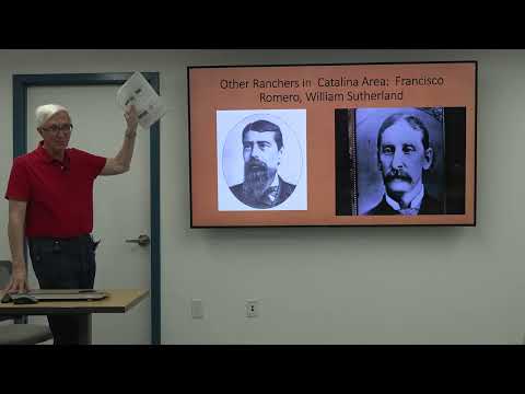
Francisco Romero was one of the area’s first cattle ranchers. He settled on a high ridge in what is now Catalina State Park and used the rock walls of the prehistoric Romero Ruin to build his home.
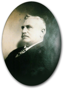
George Pusch
The best-known cattle rancher in Oro Valley is George Pusch. He and his partner John Zellweger established the PZ Ranch in about 1874. It soon became known as the Steam Pump Ranch because the men purchased a steam engine to provide a dependable supply of water from the well at the ranch headquarters. Cattle being transported for sale were watered here before being loaded on railroad cars, and travelers along the Oracle Highway found a convenient stopping point north of Tucson.
The Pusch family also used the ranch as a stopping point in trips from their home in downtown Tucson to the PZ Feldman Ranch they owned in the San Pedro Valley. Stories passed down by family members tell of Matilda Pusch’s good relations with the Indians. She traded food staples such as flour, sugar, and coffee to those who came to the ranch. In exchange she received baskets and blankets. Apache and Papago baskets and Navajo rugs obtained by Matilda still remain in the Pusch family.
In addition to being a well-known cattleman and Tucson businessman, George Pusch was also involved in politics.
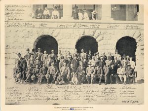
Arizona Constitutional Convention Signed, December 10, 1910
He was a member of the Constitutional Convention in 1910 that led to Arizona statehood in 1912. In the years after this he suffered a series of strokes and died in 1921. Many of his documents and records have been donated to the Oro Valley Historical Society by his grandson.
In 1933, a new era began at the ranch when Jack Procter purchased the large largely abandoned ranch from the Pusch estate.
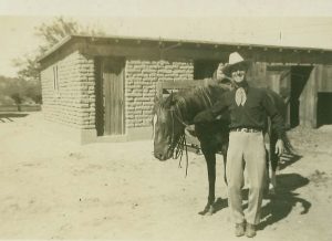
Jack Procter with Horse in Front of Horse Barn
Procter with his family had recently moved to Tucson to manage the downtown Pioneer Hotel. He built a new home on the property and used the ranch to raise chickens for the hotel restaurant. He also raised prize bulls and held community gatherings and parties at the ranch. After his death ownership passed to his grandsons and the ranch houses continued as a family residence.
Other early 1900s ranches and homesteads in the Oro Valley area provided names for roads, commercial centers, and natural landmarks. Pusch Ridge and Pusch Peak were named after George Pusch before 1900, and the Pusch Ridge Wilderness established by Congress in 1978 takes its name from these distinctive landmarks. Sutherland Wash and Romero Canyon take their names from early ranchers. The Rooney Ranch shopping center sits on the old Rooney Ranch. McGee, Hardy, and Overton now modern roadways were named after homesteaders before the late 1930s.
Settlement along the Cañada del Oro increased after World War II. The population boom in Tucson made some folks desire to live in rural areas with more natural settings.
In 1958, a portion of the former Cañada del Oro Ranch was transformed into the area’s first golf course with an associated community of luxury homes called Oro Valley Estates. This neighborhood along with development of the nearby subdivisions of Shadow Mountain Estates, Suffolk Hills, and Campo Bello included residents who enjoyed the rural setting outside of Tucson.
That rural lifestyle was threatened in 1968 when Tucson mayor Jim Corbett announced that he intended to annex all the areas surrounding Tucson city limits. Citizens in what would become Oro Valley mounted a concerted effort to incorporate as a separate town. The process was complicated, contentious, and time-consuming, taking six years before the Arizona Supreme Court directed the Pima County Board of Supervisors to incorporate the tiny 2.5 square mile town of Oro Valley in April 1974.
Jim Kriegh, a civil engineering professor at the University of Arizona, is credited with being the founder of Oro Valley.
Jim Kriegh 1928 – 2007
He held many meetings in his living room and when the town was finally incorporated, he served as the town engineer in a volunteer capacity, overseeing road improvements and the development of the El Conquistador Resort along Oracle Road. The first town police officer and town staff also served in a volunteer capacity. That spirit of volunteerism continues today in Oro Valley.
The young town of Oro Valley was established with the promise of no property taxes for residents. Oro Valley Country Club and the El Conquistador Resort provided most of the tax revenue to operate the town and maintain its minimal facilities. Until 1991, a former residence on Calle Concordia Avenue served as the town hall.
In addition to forming a town, residents north of Tucson also pursued protection of open spaces. The Joseph McAdams family who in 1940 built a home designed by renowned architect Josias Joesler sold 4,000 acres of their property at the base of Pusch Ridge to Ratliff, Miller, and Muir Investments Incorporated in 1970.
Ratliff submitted a rezoning request to Pima County to develop the land as a planned community with golf courses and homes for 17,000 people. Local opposition to the proposal was strong and Pima County put the project on hold.
The Rancho Romero Coalition was formed, and support grew to create a state park for public use. In 1974, the Arizona legislature established Catalina State Park and authorized the State Land Department to obtain the land for it through exchanges. It would take almost another ten years to obtain the property for the park through land exchanges and about thirty private land purchases and leases.
The Ratliff property was traded to the state in exchange for another nearby parcel acquired by Ratliff that would later be developed as Rancho Vistoso. Catalina State Park containing approximately 5,500 acres finally opened in May 1983. It recently celebrated its 30th anniversary, a place where nature, water, and evidence of prehistoric and historic human use are protected for public enjoyment and education.
[Music] – In the period of the 80s and 90s, Oro Valley’s population growth was significant. In order to support a community moving from rural to suburban, from a bedroom community to a self-sufficient community, Oro Valley needed to expand services. The town understood that sales tax revenue was going to Tucson and an increase in local retail was vital. In addition, the town needed to provide increased recreational opportunities. Longer term there was the need to provide local employment opportunities as well. All of these needs ran headlong into environmental concerns consistent with a bedroom community.
Politically the early 90s were turbulent. The growth engine was revved up and irreversible. Compromise with environmental preservation was accomplished. An example during this period was Honeybee Canyon. Honeybee Canyon was a highly desirable hiking experience but was also attractive to development. Hikers still enjoy the trail, and nearby homes enjoy the views.
At the same time the town purchased private property for recreation rather than residential development. The Riverfront Park with its ball fields and ramadas was proposed for apartments. Strong citizen involvement resulted in the space being purchased and rezoned for park or open space. A similar decision was made near Copper Creek Elementary School where adjacent land proposed for residential use was purchased and preserved as open space.
Controversy surrounded a proposal to build a library on the town hall campus. The expense was daunting and support uncertain. Without question the Oro Valley Library has proven to be an essential and central educational and interactive community value.
With the friction over the pace of growth, the town during this period demonstrated balance in the acquisition of park space including the additional purchase of the Naranja Town Site. The town site was intended for some town facility expansion but the citizen support for more recreational amenities created a master plan including a community center, performing arts facility, and dog park, passive as well as active recreation space.
Subsequently the cost of development consistent with the approved plan challenged citizens financially and the bond issue was defeated. Oro Valley intends to add multi-use fields and a dog park, but the ultimate final use remains of interest and debate.
Another key to balance of growth and conservation during this period was the recognition of the town’s most important historical property at Steam Pump Ranch. Although the owners wished to develop the property because of its location on Oracle Road and strong market demand for commercial use the town utilized a county bond issue to raise the money to purchase the entire property. The town is faced with significant costs for restoration, and it is likely to be years before the ranch achieves its intended purpose as a cultural center for historic research as well as tourism and special events.
Keeping the scales balanced is difficult. The town approved an ordinance declaring Oracle Road and Tangerine Road scenic corridors. This meant larger setbacks for development, maintaining vegetation, and reduction of visual impacts.
At the same time the town created an industrial park, Innovation Park, core business being Ventana Roche. Subsequently, Sanofi and the Western National Parks Association built within this ideal location buffered by Oracle on the east and Big Wash on the west.
Adjacent to Innovation Park is the Oro Valley Hospital with adjoining medical offices. Oro Valley has achieved what few towns its size has a variety of housing styles in every social economic preference, very accessible park space, excellent schools, growing light industrial, and convenient quality retail.
Reducing leakage, the loss of local retail sales taxes, remains an important objective. Providing a large regionally attractive shopping center was an opportunity that couldn’t be overlooked. Oro Valley has the ideal location at the foot of the Catalina Mountains with Oracle Road on one side and Tangerine Road on the other.
The space was troublesome for any developer as a riparian area ran directly through the property. In addition, a well-established medium density residential area bordered the parcel at the rear. Not only was development controversial but a development agreement offered by the town to the developer was contested by a referendum indicating a change in appreciation by the community for quality shopping. The referendum was defeated by a sizable margin.
The Oro Valley Marketplace was finalized, not only protecting the riparian area but including a water harvesting system unmatched in the area.
Proceeding to maintain a quality lifestyle for all residents is exemplified by the mass transit system approved recently. Sun Tran buses and vans circulate locally, provide a dial-a-ride service, and offer service to central points in Tucson.
The town has spent millions to widen local roads to include multi-use paths, bike lanes, landscaped medians, and right-of-ways and deservedly is acknowledged as not only bicycle friendly, one of the state’s most playful towns, but importantly one of Arizona’s safest.
Highlighting Oro Valley’s quality of life is a very active local arts council. The Southern Arizona Arts and Cultural Alliance [Art State Arizona as of 2025] grew from a town advisory board into an independent 501(c)(3), successfully managing excellent art and craft exhibits as well as symphonic, contemporary, and jazz concerts throughout the year. SAACA also provides musical education in schools as well as Just for Kids performances each month at Town Hall.
A notable visual art addition is the town’s public art requirement. One percent of new construction cost is set aside for art publicly displayed at the site. Throughout the town, creative unique art is prominently displayed as new development is completed. [see The History of Public Art in Oro Valley by Dick Eggerding]
The Oro Valley Historical Society has spearheaded the restoration and promotion of Steam Pump Ranch in collaboration with the town’s Historic Preservation Commission.
Volunteerism is abundant in Oro Valley. The town remains committed to the hospitality industry. The Hilton El Conquistador has expanded its convention capacity significantly. Together with unequaled views, desert trails, camping, history, tennis, cycling, golfing, walking, and jogging, it’s not surprising that Oro Valley offers visitors a comprehensive menu of relaxation and fun.
Oro Valley completed a modernization of its public swimming facility and now attracts competitive events as well as continuing to offer residents the use of our unique championship Aquatic Center.
The evolution of Oro Valley from the rural ranching and agrarian lifestyle to today’s self-sufficient town is a history of aspirational and environmental respect. A quality of life consistent with the interconnectedness of business, personal, and family needs while retaining respect for our heritage.
This could not have been accomplished without citizen participation at each step in Oro Valley’s maturing as a great place for citizens of every age, occupation, and interest. Oro Valley relied upon task forces, open houses, newsletters, or subcommittees to ensure citizen awareness and collaboration. Quality of living it’s in our nature.
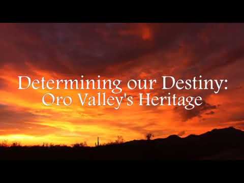
In this two-part series, historian Jim Williams details the early development of Oro Valley from its Native American roots through initial settlement and homesteading to the rise of large ranches and early suburbia.
Devon Sloan: Hey everybody, welcome. I’m glad you all are here. You’re going to be glad you’re here too. The Oro Valley Historical Society is thrilled that Jim Williams is a past president, current historian, and author of the book Oro Valley: The First 50 Years. You all know that because I’m sure you’ve read it. There’s not going to be a quiz on it, but it’s a great book. He’s here today to talk to us about Oro Valley from then until now, but he won’t tell you everything. You can come back next week, same time, same station, to hear more of the story. Here is Jim Williams.
Jim Williams: All right, thank you. Yeah, this will be a two-day session, and if you know anybody who is interested, they can certainly come the second time. What I’m going to do today is primarily talk up to the period of incorporation and then go from there — the modern history — next week.

For those of you who don’t know me, I’m a resident of Oro Valley. I live in Sun City. I’ve been here 18 years. We moved here in a heatwave in June of 2006, and our air conditioner broke three days later. That was our introduction to the heat of Oro Valley, and I think it was about 105. But I have been a teacher and an administrator back in Pennsylvania, in southeast Pennsylvania, and I have been working with the Historical Society since 2013. I published a book, Claiming the Desert, in 2018 and published a new book about modern Oro Valley for the 50th Anniversary. I had not intended to write a book again, but along came COVID and I had lots of free time, and I had a lot of material. So I thought if I added to that material, I could perhaps create another book covering this community.
[“What Historians Do” slide] What do historians do? They gather information, data, pictures, events, newspaper articles, try to look for patterns and trends, and then organize that information to clearly explain patterns and trends. A history is not just a listing of a lot of details. You may have some history teachers that did that; they just went over detail after detail after detail. I think it’s more important to explain history and use illustrations to explain major ideas rather than always dwell on all the details, etc. So that’s what I’ve been doing, and you can see newspaper articles. But one thing we have today, which I’ve mentioned in a couple other talks recently — this is the first research project in 50-some years of research, 54, 55 years of research. This is the first project I’ve ever done primarily through the internet because there is so much now on the internet that you can do. Now, interviews and things like that are extra, but newspapers.com, ancestry.com, all kinds of sources that can help find the information you want.
[“Slow Settlement of the Southwest” slide] So let’s talk about Arizona and Oro Valley. You probably know that New Mexico and Arizona were the last two states to join of the lower 48, and there are a number of reasons for that. For one thing, up until the 1860s, if you look at maps of this area, the name Arizona is often in small print, and the word Apacheria is in large print because there were more Native Americans than there were settlers, and this was a dangerous place to come to, certainly until perhaps the mid-1870s. And if you came here, there were simply a few paths from Santa Fe and El Paso that would lead you in this direction, and I mean truly barely a path to get here. So you would have had to walk or pull a cart or ride a horse or maybe a wagon, perhaps. So that would have been quite difficult, and most of the people until the Civil War were not coming to Arizona; they were coming through Arizona, going to California. California had gold, California has fertile land, it has a nice climate, and it was more attractive. So most of the people were not staying here until after the American Civil War. And of course, we had the climate problems here. Can you imagine living at the Civil War period in an adobe house with windows, with no screens, no air conditioning, no fans, no nothing, and getting through the summers here and other difficulties? So we didn’t become a state until much later. Some of the members of Congress, even in the early 1900s, said, “We don’t want Arizona. It’s going to be a basket case. It’s going to be a dependent state that is always going to need help from the federal government to survive.”
[“Oro Valley – Delayed Settlement” slide] Oro Valley, similarly, was delayed in settlement. The darkened line that I created is roughly the path of the Southern Pacific Railroad. The closer you were to the Southern Pacific Railroad, the more valuable your property because you could get things in and out of here after the early 1880s. As you can see there, the green areas are parks, but they’re also the mountainous areas. So there is only one major route north that doesn’t go through the mountains, and that’s what we now call Oracle Road.
We were far from the railroad, and all of this land up here — actually, all of the land north of Grant Road — you know where I’m talking about in the middle of Tucson — all of the land north of Grant Road was owned by the federal government. Nobody could, at that point, take the land. They could occupy it, but they couldn’t own it because it had not been surveyed or made available yet. So people would come to this area, but they couldn’t own the land, and it was a long way from the railroad. So if you raised cattle, you had to get them to the railroad. If you dug ore in the mountains, you had to somehow get that to the railroad. So you can see why Oro Valley would have developed much more slowly than some of the areas closer to the city of Tucson.
[“Interface of Distinct Cultures” slide] We have an interface of cultures here. We have Hispanic — Francisco Romero on the left — we have Native American, and we have Anglo. That gentleman, I tried to find his name; I couldn’t find it, but he owned a section in homestead that is now called Shadow Mountain Estates. That was his property. The man on the top right — they would have referred to him as an Anglo. An Anglo is any European of non-Spanish origin. It doesn’t mean English like British. It could be a Jew from Poland, it could be a Greek, it could be a Swiss national, a German, and there were all of those people who came here from those different countries. But all of these people are going to intermix in this area.
[“Competition for Land, Resources” slide] The resources in the land of this area, when it became available, and even before it became legally available, various groups are going to compete, push other people out of the way. We always talk about the Apaches of this area, but they were not a native tribe to this area. They came in and pushed other natives out, and the same thing occurs here. There’s going to be a competition for the land and the resources and how to get rich quickly. I just came upon a phrase reading a book about the environment — something the social scientist, environmentalist called “The Tragedy of the Commons.” Does that ring a bell with anybody? Tragedy of the Commons? I had never heard of that before, but it basically is the idea that any place where there is open land and there’s a lot of resources there, there’s going to be a competition for it, and many people feel that they’re going to take it first because they know somebody else is going to take it and make use of the resource anyway. So why not go ahead and take it and get as much as you can out of it? In our area, it would be cattle, but it could be timber, it could be iron, or other things of that sort. There is not a particular concern about the environment when these people came here. They might have enjoyed the look of the environment, but they weren’t really concerned about the long-term survival of it. And so there is going to be a competition and, in some ways, an overuse of the area.
[“Tribes in the Area” slide] So we have, first of all, the Native American tribes here. Long ago the Hohokam – from the 500s to as late as the 1400s – a civilization that reached its peak around 1100 CE. The modern tribes would be the Tohono O’odham which in the 19th century were called the Papago and the Apache in the northeast of here. So think of this area here as kind of a no-man’s-land between the Tohono O’odham towards the Santa Cruz river and the Apache to the north, who would periodically come into this area.
[“Hohokam – Romero Ruins” slide] So the earliest settlers – the earliest people that we know of, they were probably earlier than this – were the Hohokam, who settled on the bluff in what is now the middle of Catalina State Park. Over 100 people lived on that bluff, it’s the section of the park that’s set off and called “Romero Ruins,” but that refers to a later settler. They built walls, buildings, etc. They used the bluff for protection. That area behind there is slowly rising towards the mountains and those were all agricultural fields with canals directing water through that area.
[“Apaches” slide] The Apache came here much later. They came from Canada. They were warriors, they were raiders. They thought that stealing livestock was a legitimate occupation. It was what you did to make a living. So they would steal from Tohono O’odham. They would also steal from other tribes, and they would also steal from the Anglo settlers and Hispanic settlers here. Later, they also attacked travelers and wagons coming through the area, and they were a very, very strong threat to anybody moving here. So if you lived in Tucson at the time of the Civil War, you would have had to have been very courageous to come way out here because there would be no protection. Now, about four years later, the federal government brought an army into this area under General George Crook, and they largely pacified or dealt with the Native American threat. But until that period, it was quite, quite dangerous.
[“Three Waves of Non-Native Settlement” slide] So again, taking all this information about all the different people, etc., I found a way to organize it was to think of waves of people coming here — non-native people. I just mentioned the native waves coming in, the Tohono O’odham, the Hohokam, and the Apache. But I broke it down into early settlers, homesteaders, and then the major ranchers that came here. And I’m going to talk a little bit about each one of those. And by the way, we’re the fourth wave. We’re suburbia. So, we’re the fourth wave coming through this area.
[“Earliest Settlers: Wave 1” slide] So the earliest settlers that came here, non-native, probably came here between 1865 and 1900. They held no title to the land. They established the early ranches, and they held no title to the land, and they all decided to raise cattle here.
So imagine coming out of Tucson and you come up here, and you probably build some kind of a shelter. You would dig a well because you would need water for any animals, and then you bring cattle here and you let them loose. You’ve branded them with your brand, so they’re going out all over this area between the Tortolita Mountains and the Santa Catalina Mountains and all the way up as far as north of Oracle and all the way down towards Tucson.
So no one at this point in the late 19th century owns this area. You brand your cattle, you let them loose, and then sometime in the late fall or winter, you round them up in a rodeo and you bring them back. And all the skills that we think of in the rodeo today are part of the skills of rounding up those animals. And then not only you, but perhaps five or six other ranchers would get together and you would all work together to capture all those animals, and then you would divvy them up based on their brands. And then they would be taken either to Tucson for butchering or to the railroads.
About half these early settlers were Hispanic and about half Anglo. They were squatters. They did not own any territory. They probably hoped at some point in the future there would be a legal way for them to get that. One other characteristic of this period is that there are no fences — very few fences. You didn’t own the ground yet, so why would you fence it? Because you don’t know — you may or may not be able to get it. Nobody even knew exactly what the parameters would be of the lots that would be available because that was all still to be determined in the future.
The railroads come here in the 1880s, and now you have a way to ship cattle out of here. You have ways to ship ore out of here and ways to bring in new products and more people. The railroad comes from New Orleans through El Paso, through New Mexico, and then to Tucson, and then eventually all the way to California. The fact that the railroad comes from New Orleans is very important because most of the people who are going to come here between 1880 and 1920 are going to be Southerners, and they’re going to come and bring their social system that was common to them. It’s going to come here. And as some of you may know, Tucson was a segregated city until the late 1950s, early ’60s. So, segregation came with that group of people who came to this area. So, the railroads bring in materials that people can use. They bring people who are coming here who hope to get some property eventually.
George Pusch
Earliest settlers that we know of: Francisco Romero and George Pusch — Anglo and Hispanic. George Pusch was a German immigrant. We know from ship records that he got here in the fall of 1865. He came from the central part of Germany near Frankfurt, and like many people of that era, he traveled all over the West. He didn’t just come from New York City and immediately right to Tucson and say, “Well, I’m going to live here.” He lived in San Francisco, he lived in Los Angeles, he lived in other cities until eventually he found the place that he was comfortable with, and that would be somewhere around 1873 or 1874.
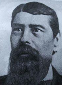
Francisco Romero
[“Romero Ruins” slide] Francisco Romero is a local. His father was a soldier for the Spanish Army that was here in the early 1800s in the presidio. He did some scouting for the Mexican Army because remember Spain was replaced by Mexico, and then Mexico eventually ceded this territory to the United States. He was a son of a soldier. He had a Mexican land grant where Oracle Road meets Grant Road, if you can think of I-10. I mean, that’s a whole industrial area down there and warehouses and things like that, but that was his original ranch, and he had some dairy cattle in that area.
We know from records that have been submitted and are still in existence that he came here at least by 1869, perhaps earlier. He built upon the Native American ruins. I’m sure this was partly crumbled, and we have photographs that he eventually built these walls up to about like here. They were about twice as high as they are today. Pictures were taken in the early 20th century of these ruins that show what he did with them. He established a mine in Romero Canyon. He raised cattle here. His son developed an orchard out in that flat area — kind of where the entrance road is and you go through all that flat — well, that was an orchard that his son operated there. And he survived in this area, but this was again pretty tough — 1869, 1870. Romero and other primarily Hispanics wrote a series of petitions to the territorial government — you see 1869 and 1870 there — and one of those pages, or one or two of those pages, are his personal petition saying that he had been attacked, that his home had been attacked by Apache. They had stolen cattle. They had stolen other things. And you never know where you’re going to find these things. I didn’t even know this existed. And I looked on ancestry.com, and I just happened to look up Francisco Romero, and somebody had tagged this document from him, and it’s in the Stanford University Library in California. And some very diligent genealogist found a lot of this information. By the way, there are lots and lots of Romero’s that still live in the Tucson area that are related to Francisco. His family claimed that when he was buried, he had arrow wounds that were in his body from being hit by arrows in various attacks. But he had one of those Winchester repeating rifles — remember like The Rifleman had on television with the action thing like that — so he survived.
[“Steam Pump Ranch” slide] Just to mention also one last thing about the Romero’s: he and many of the other Hispanics and Anglos were very angry at these Apache raids. And so he and others agreed to form a posse and to arm themselves and to go north and look for the warriors. They had heard they were in Aravaipa Canyon. Has anyone here ever hiked through Aravaipa Canyon — the water? Yes. It’s a narrow, not too high canyon, but to walk through it, you have to walk most of the time in the water.
They went up there. They left late at night, and they rode up there in the dark because they wanted to come in secret. And most of the materials were supplied by Sam Hughes — that’s a name well known in the Tucson area. But when they got there, they went up on the bluffs above, and they decided to attack. What they were attacking was primarily women, children, and a few old men. The warriors were off somewhere. And not only did they attack and annihilate over a hundred of them, but they took hostages — children — back with them to Tucson. And Romero took a baby back with him, a young child, and made it a house servant. And later, much, much later, the tribe sued for the return of all those children, and they got them back from Romero and other families.
So George Pusch established the Steam Pump Ranch. He was a butcher, his documentation getting into the country mentions he was a butcher from Germany. He establishes a shop in downtown Tucson which is an open-air shop – the historical society has photographs of it. He works in collaboration with a Swiss national by the name of Johann Zellweger and they were partners in many things including a meat processing plant, establishing the ranch out here, and raising cattle in this area.
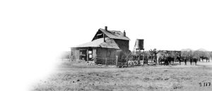
Pump House at Steam Pump Ranch
So he, like many people, is coming here to make the quick kill. There’s all this open land, he’s a butcher, he has a meat processing plant, all he needs is more meat. So he is going to establish a ranch here and make as much as he can as quickly as he can. He also established a ranch on the San Pedro River, a much bigger ranch where more of the cattle were raised. This ranch is more of a way station between the ranch on the San Pedro River north of Oracle and Tucson.
He had a steam pump imported; I don’t think it was the first steam pump in Arizona, but it was one of the early ones. That allowed him to draw water from a deeper level so that he could water his cattle and other people’s cattle for a fee.
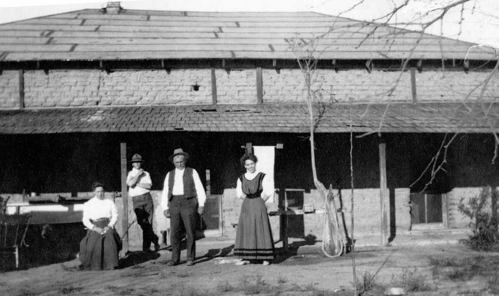
Some of the Pusch Family in Front Yard – Mathilda, George Jr, George Sr, and Gertrude c.1900-1905
This is a picture from the late 19th century, perhaps early 20th century, with him, his wife, and two of his children. Unfortunately, many of these people referred to these waves of people coming out with the idea of making a great deal of money as bonanzas. Remember the television show Bonanza? It was an opportunity to really make use of the extractive process—extract ore, cut down lumber, or use the grass to feed the animals. The unfortunate part is that these cows didn’t know that they had to be ecologically sensitive. They ate the whole thing; they pulled the grass out by the roots, and so next year that grass was no longer there. Within ten years, it was no longer as easy or profitable to make a great deal of money. In fact, many of the cattle after 1890 were only raised for a year here and then shipped to California to be fattened up, which made it less profitable. If you could just let these animals loose, let them graze on all the material, and then collect them and sell them, that’s a gold mine—but it didn’t last for too long.
[“Wave 2: Homesteaders” slide] Second wave: the homesteaders. Some of the early settlers did end up with homesteads, but they were not the majority of the people who would be called homesteaders. Most of the homesteads were settled between 1903 and 1940. They claimed anywhere from 40 to 640 acres. 640 acres is a square mile; that was the most you could claim. Once you obtained a title to the land, you also wanted to protect it, so you put a barbed wire fence around it. That was the end of the open range.
You may remember that old Cole Porter song “Give Me Land, Give Me Land and Starry Skies Above, but Don’t Fence Me In.” That was written about the process of putting up all those fences. It’s hard to be a cowboy when you can only go one mile before being fenced in. There were some ways to get around that.
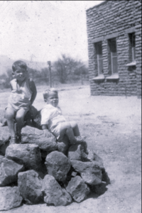
Dan and Jim Reidy in Front of House
These people came from all over the United States and Europe. There were actually a few Black gentlemen who claimed land, but mostly Anglos and Hispanics—probably about two-thirds Anglo and one-third Hispanic. That was a rough proportion. For approximately $25, plus another $10 for the deed, you could claim 40 acres, but you could also claim 640 acres for the same amount of money. Some people only claimed 40 acres, but a lot of them did. Others claimed more and held on to that land. They built themselves an adobe house, and they may have built some kind of entryway, like the Moonglow Ranch, to make it look very important. They settled in this area between 1900 and 1940.
[“Federal Govt. Establishes Townships” slide] A friend of mine, Clive Probert, created this map for me. He shows the four townships that were established, of which Oro Valley is most of that land. You can see the rough outline of the green area of Oro Valley, though that is from perhaps 76 or 77 years ago, so it has probably changed slightly. The greenish area represents Oro Valley today, and part of Oro Valley is in each one of these four townships. This township, 12-14, is almost all mountains, so the federal government retained most of that, and it was made a forest preserve around 195 [inaudible] by Teddy Roosevelt. It still remains a forest preserve of the United States.
Notice how precise the lines are and how the roads in the valley are basically aligned with the sections. This is a 160-acre square section. There have been some changes to the roads, but roads are generally drawn between sections. Each township would have been divided into 36 sections, subdivided into four 40-acre sections, 1,680 acres total per township. Notice the big dividing line: Tangerine Road and First Avenue. First Avenue is the red line coming down, and Tangerine is the bluish one going east and west in the middle. When you’re at Walgreens at First and Tangerine, you’re roughly in the middle of those four townships. These townships were all laid out by the government and then had to be surveyed. People came out on horseback starting in 1901 with a pole, a transom, and a chain. They would measure 100-foot sections at a time, placing markers along the way. Most of those markers are gone now because they were in the middle of roads. Some markers were pipes or large stones with numbers chiseled on them. Starting in 1903, you could begin claiming from this section here. The last section settled was farthest from Oracle Road, making it the most difficult to access, as the other roads didn’t exist yet.
[“Homesteaders: Life was Harsh” slide] Some pictures show ruins. The one on the right was in Catalina State Park. When the park was built, the decision was made to tear down the homestead ruins. I wish they had at least left the foundation there. But they bulldozed them and got rid of them because they were afraid kids would get in there and fool with them and the wall would fall on somebody. The ruins were still there as late as 1982 or 1983. The one on the left was near the southern border of Oro Valley Country Club. The family that built it didn’t pay for a survey, and the house ended up 100 feet off the property line. They solved this by lifting the house onto telephone poles and rolling it to the correct property. Ingenuity was a big part of being a homesteader.
640 acres seemed like a lot of land, but it wasn’t enough for cattle. One head of cattle requires 25 to 40 acres of land and forage. You couldn’t make money by bringing in feed—it was too expensive. Many homesteaders had to rely on neighbors’ land for additional grazing. Wells were dug by hand, 25 to 100 feet deep. They started wide and narrowed the well to prevent collapse—it was dangerous work. Early homes were stone or adobe; in the 1920s and ’30s, people built small frame houses. Most houses were tiny, four or five would fit in a single room today.
[“Children, Early Education: Catalina School” slide] Tucson, or rather Pima County, had 18 or 19 school districts. This area, from the Pinal County line to River Road, was the Catalina School District, established in the 1890s and lasting until the 1940s. The one-room schoolhouse was on Oracle Road opposite the Oro Valley Marketplace. It has been heavily modified, but the location and frame are original. Students were mostly Hispanic; graduates went to Tucson High School if they could make the commute. Students were often mocked for their accents. Amusements for children: riding horses, swimming in Romero Pools. Does that ring a bell with anybody? Parents were helped, and children attended school despite being the poorest district in Pima County, with a budget around $1,000–$2,000. The library could fit on a single table.
[“Francisco Marin Family” slide] One example of a Hispanic family lived near the entrance of Oro Valley Marketplace. Francisco Marin and his brother had ranches nearby. The Francisco Marin Ranch was a stagecoach stop. The Arizona Historical Society has a ledger documenting stagecoach trips, passengers, and freight. The stop was crucial for exchanging horses and delivering goods, especially up steep hills, which was challenging with wagons and horses.
[“Women Homesteaders – Ina Gittings”] We also had about 10 women who claimed homesteads on their own. The law was written at that time that if a man and a wife, husband and wife, took a homestead, it was automatically put in the man’s name. There’s no mention of the woman. Now, if he died, she inherited it, but legally, if there’s a husband and wife, it’s his. But single women could come out here on their own. Can you imagine what that was like for a single woman to come out into this open area and either do the work or have others get the work done?
Probably the most famous of those is a woman by the name of Ina Gittings. She was a professor of physical education at the University of Arizona, and there is a hall named for her on the far eastern side of the campus.

She was a pioneer because she went to college, and she was one of the first people to come to this area to teach physical education to women. Prior to this, the thinking was that women should not participate in sports, and she helped change that. She was a professor there from the World War I period, right after World War I, until the mid-1950s. She lived in a home in what is now the middle of the campus, but it was part of private property then.
This is a picture of her. I was able to obtain these pictures from one of her nephews or great nephews.
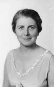
Ina Gittings
She established a homestead on Ina Road and wrote a series of letters to the newspaper saying, “Please pronounce my road correctly. It’s [Ee-nuh] Road. It’s not [Eye-nuh] Road.” That never took. She used to invite her girl students on the weekends to come to her homestead. They would get horses from the University—they had polo and all that stuff—and they would ride all the way to La Cholla and Ina Road, and that’s where her property was. But she also owned a lot of land very close to Sun City. Not everybody was able to get 640 acres of contiguous land, so sometimes they got 300 here and 400 there, and it wasn’t always a perfect square. It depended on how many people had asked for that.
These people had to take care of themselves. Particularly, if there was a man and a woman, the woman was expected to take care of the house, take care of the garden, take care of the kids, do the sewing, do all that kind of business, keep the house as clean as possible, though most of them had dirt floors, so it must have been very difficult to try to keep any kind of cleanliness with the dust, etc. They also were the medical technician. If somebody got hurt, they were the person to take care of it. If you’re living way out here, you’re not getting in a buckboard and going all the way to Tucson for a doctor. Number one, they didn’t have the money for it, and number two, they probably wouldn’t have been able to get there in time. So the mother or whatever female was in the area had to have some medical skills, and they had to find ways to save people.
[“Wave 3: Wealthy Easterners” slide] Starting in the 1920s and continuing until the 1950s, another group of people began to move here. They were quite different in that they were much more economically successful when they got here. Many of them had big businesses in Ohio, Illinois, and other states, and many of them came here as winter visitors. During the Depression, many of those original homesteaders could not afford to pay the real estate tax, which was generally on a piece of open land between $2 and $7 a year. But they didn’t have $2 or $7, or many of them had mortgaged their properties because they wanted to buy a piece of equipment. When the Depression came, they couldn’t pay the mortgage either. The property was available, so these people came along just as many people were losing their properties, and they bought up many of these for very small amounts of money.
If I had spent $35 buying a homestead and I built some little adobe three-room building on it, and somebody came by and offered me $500, you would take that. That would be a big profit. In the Great Depression, people were only making an average of about $800 a year. These people could come along and buy up the land. They were going to be gentleman ranchers. They were not going to be digging wells and tending cattle; they were going to have a foreman, ranch hands, and various people to do all that work. Many of them were only going to be here from October till April. Sound familiar? They began to consolidate the land into large sections, and as I’ll talk about next week, that has tremendous implications for the way Oro Valley was developed because it’s not 80 different little sections all over the place. Many of these have been grouped together by these people starting in the 1930s and going until the 1950s.
[“Wealthy Visit Tucson – Winter Visitors” slide] They were winter visitors.
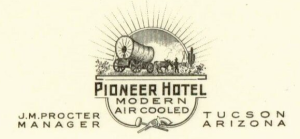
Pioneer Hotel Postcard Stationary JM Procter Manager Tucson AZ
They came to the hotels; they came to the places with swimming pools. There is a gentleman who had a homestead here, and now the name escapes me, but he had a homestead where the Hilton El Conquistador is. He was also involved in the motion picture industry. He and his wife established a little company and employed several cameramen. They would go around and take little three- or four-minute clips of interesting things in the desert: things like girls dressed up at a swimming pool with cactus covering them, a lot of pictures of girls in bathing suits around swimming pools.![]() What they did with these was sell them as newsreels in the old motion picture theaters. People back east would see these pictures and say, “Wow, I think I want to go out there in the wintertime.” So they would come and stay at a ranch, the Pioneer Hotel, or one of the other hotels.
What they did with these was sell them as newsreels in the old motion picture theaters. People back east would see these pictures and say, “Wow, I think I want to go out there in the wintertime.” So they would come and stay at a ranch, the Pioneer Hotel, or one of the other hotels.
[“Rancho Romero – Joseph and Lyla McAdams” slide] After several winters, once they had looked the area over, they thought, “Maybe I think I want to have a ranch,” and it wasn’t going to cost that much money. One of them was Joseph McAdams and his wife, Lyla. The map I have here is a map of Catalina State Park, and the outline in color is their ranch. Their ranch made up about two-thirds of Catalina State Park. McAdams was the owner of a steel plant in Cincinnati, Ohio. He and his wife came out here in the 1930s, bought this land, and built a house right where that dot is. That house is still there today. It’s on Oracle Road, about 100 yards north of Tangerine on the right-hand side. Way back in, I’ve been through the house. It’s very interesting. They built a swimming pool and had cattle on the ranch. They had five or six different corrals. They enjoyed that area and certainly were not going to be doing a lot of work.
The house was built in the late 1930s or early 1940s. It was designed by Josias Joesler, which made it important. It’s an unusual home. It has five bedrooms, each with a bathroom, a servant’s quarters, and a huge living room. It’s probably at least as big as this area here—maybe a little bigger—with beautiful windows looking out over the mountains. We’ll talk about that next week.
[“Rancho Vistoso – Walter McDonald, The Golders” slide] Walder McDonald was a single gentleman. He owned a printing company in Ohio. He came here in the 1930s, and in 1946 he bought out someone else who had been accumulating land just north of Steam Pump Ranch. It didn’t have a name at that time. It was owned by Joseph Melrose, so he sold it to him in 1946 for about $50,000. He would come here every winter. He was a member of the Tucson Country Club. He subsidized opera here and helped make sure it continued. He had a home on this ranch, but his real home was over on the road to Mount Lemmon. In fact, there’s a park over there named McDonald Park for him. He donated that land to Pima County. He was active in the area and established a ranch, and about 1953 he started to refer to it as Rancho Vistoso, and that’s the beginning of Rancho Vistoso. It was 4,500 acres.
I should make a quick point here about this. Many of these people did not own the entire ranch because, perhaps, if you can think of this room, perhaps they owned like this section here and that section over there, and this section here and that section over there, and the land in between was owned by the state, and they could rent that. They could lease it for a very nominal fee. So he owned perhaps 3,000 acres, and the rest of it was land that the state allowed him to use so he could have a contiguous ranch.
[“Leisure on the Ranch” slide] These people entertained. This is a picture from the Proctor-Leiber House.
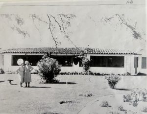
Procter-Leiber House Back Yard, 1940
They rode horses, they had swimming pools, they invited celebrities to come up, and many of them were invited by somebody else and then they got the bug to buy. They would spend a weekend or a couple of days at one of these ranches. Many of them came to Steam Pump Ranch, and then they would go and buy their own ranch. So, by the late 1940s and early 1950s, there wasn’t much open ground left. There were lots of other people here; however, people like Buster Bailey, lots of poor people—you know, the average person was a poor person.
There were the Golders and there were Walder McDonald and people like that, and they lived a level way above everybody else. I think you could safely say that in the 1930s and 40s, there was no middle class in Oro Valley. There were wealthy people and there were very poor people, and the very poor people were ranch hands, tenant farmers, people who did odd jobs.
[“Buster Bailey: Itinerant Worker, Historian” slide] Buster Bailey is a good example of this because he came here with his parents from Texas in 1928, and his parents established a gas station on Oracle Road in 1929.

Buster Bailey
Not a good time to start a business. The business failed about a year later, and they went back to Texas. Buster said, “I’m staying here. I like it here. I’m going to find a way to make a living here.” So, in the Great Depression, what did people do? Well, he thought of himself as a cowboy, but he was not a cowboy. He was a mechanic. He was a very gifted automobile mechanic; the kind of person who could figure out how an engine works and repair it. During World War II, he repaired jeeps in the Philippines. He was stationed there. But, you know, you did just a little bit of everything. You might have an illegal still and make alcohol during Prohibition. There’s lots of remnants of old stills in this area—sheet metal out in the desert. It wasn’t because somebody had a steaming engine there; it was probably a still. You pick cotton—there was wild cotton in Romero Canyon—and you could pick it and fill up a bag and sell it. Can you imagine how long that would take to fill one of those big sacks? You dug wells. How do we know all this?
Fortunately, Buster Bailey, in his old age, began to write down what this area was like. He wrote a series of essays on tablet paper. He wrote about the people here and what they did and how you dug a well here. You always checked when you came back the second day to see if there were any rattlesnakes down there before you started digging again. He has a lot of those things. It’s a very interesting commentary on the era and the people who lived here. Unfortunately, he did not begin writing this until many years later, and there’s some confusion of names and places, etc., but it’s still a very valuable listing. So, if you don’t know what to do with your time, write down your own history and save it.
[“Could You Have Been a Settler?” slide] Could you have been a settler? Could you have come out here and rode a car, rode a truck, rode a wagon, dug a well, built a house? By the way, to keep the property as a homestead, you had to improve it. If you didn’t do anything to it, you couldn’t get a deed. But what people often did was they said, “Well, your ranch is over there, and I’ll sign a deed that says you built a house, and you sign an affidavit that says I built a house,” and somehow, they got around it in that way. But you had to be self-reliant. You had to be willing to live in isolation.
The streams that we have around here frequently flooded, like the CDO Wash, and when those things flooded, you could not get across them. Do you remember what Catalina State Park looked like last year when they had all those floods? It wasn’t just the water, but all that wet sand to get through it. So, you’re not getting a car through that. There was no electricity. There were no fans. There were no swamp coolers. There were no air conditioners. You had to find a way to keep cool. What they often did at that period was if they had an icebox and old ice, they would take their sheets at night, soak them in ice water, and then wrap everybody like a mummy, and that evaporation would make you feel cooler. You had to be initiative; you had to be able to survive on your own, and you also had to find a way to make a living. Not very easy here. I’m sure most of us would not have lived as long as we have today if we had been in that situation, and many of them did not live long lives because if they had a medical condition, many of them could not afford treatment.
[“Post WWII: People Move to the Southwest” slide] Post-World War II, Arizona, in the Sun Belt, begins to grow. People want to come here. During the war, many people came here to military bases, or they traveled through here on the way to the West Coast to the Pacific Theater. People spent time here in the military, particularly in training and aircraft—flying, navigating, etc. When the war was over, they thought, “I would like to come back to a place like this.” Also, there was an aircraft industry that went along with the aircraft training here. Planes were built here. People came here to work, and then they decided to either come back or stay here.
In 1938 or 1939, somebody in Tucson invented the swamp cooler. Have any of you ever seen or lived with a swamp cooler? Yes. It only brings the temperature down about 7 or 8°. So, if it’s 110 outside, it feels a little better. It’s basically circulating moisture around your house. But then in the 1950s, air conditioning became available. People often say, “The Midwest came here when we finally got air conditioning.” People largely in the post-war period came not from the South but from the Midwest, and they came to this very unpopulated state. We had two senators but only one member of the House of Representatives. That means you were a very small state. That one member of the House of Representatives had to go and travel over the entire state to visit with constituents.
[“Transportation Improvements” slide] We went from cars like at the top to cars at the bottom—more aerodynamic cars, straighter roads, paved roads, and faster cars with V8 engines. So, the roads had to be improved. The first road that really had to be changed around here was Oracle. Oracle Road is likely an Indian path or a military path up to Camp Grant, and it just kind of meanders all through the area. I’m sure it was looking for the best elevation to be able to get horses and wagons up through the area, but more and more roads are going to be built like this.
I’m sure you’ve all had Gelato at Frost, right? Well, if you came here in 1950, you’d be in the middle of Oracle Road. Frost—that Oracle Road took a big swing there and went through that whole Casas Adobe Shopping Center, where I mentioned before, where the school is. From Tangerine coming down that hill, that whole road had to be re-engineered because people frequently were killed on that road. They would come down too fast, and the curve was too sharp. If you come down, well, best way to—if you remember where the entrance is to Catalina State Park, you know where the sign is, the big sign—if you go about another 100 ft, you’ll notice there’s a dirt road there. That’s Oracle Road. That’s the original Oracle Road. It’s just a dirt path there. There’s one property that you can enter from that. So, the roads are going to be improved; they’re going to be paved. Oracle is a two-lane road. In 1950, they said, by the way, in the 1930s that they were paved, but they were not paved. They had gravel, and they put oil on them periodically, and it would wash away in the rain.
[“Suburbia Comes to OV – Campo Bello” slide] We have the beginnings of suburbia. In the 1930s, an English couple owned a section called the Linda Vista area. They asked the county to allow them to subdivide it. So, in 1935, we had our first subdivision here of the area along Linda Vista Boulevard. They were generally large lots because originally many people thought of having a little ranch out here rather than a suburban kind of housing.
Campo Bello, 1948. It’s between Hardy Road and Calle Concordia, to the west of Oracle. It’s about a half mile back. It’s an unusual development. It’s a 160-acre homestead section, and it is divided into five-acre ranchettes, and most of the people still have horses back there. The roads are not paved, and they don’t want you really driving through there. If they paved it, more people would drive through there. So, it’s kind of a little nook of early suburbia through this area.

Margaret “Daisy” Howard, Countess of Suffolk
[Applause] The Countess of Suffolk came here in the 1930s. She was one of those wealthy people. She was a daughter of a gentleman who owned a department store in Chicago. She was sent to England to find a member of nobility to marry. It’s kind of like Downton Abbey. She had the money, and he had the title. She married the Earl of Suffolk and lived happily ever after until he was killed in World War I. He died in 1916, and she became the Dowager Countess. She is not an Earless Countess. That’s a painting of her. She had a home built, which is still existing. It’s part of the Immaculate Heart complex. It has been occupied by nuns, though I understand the high school is closing, so I don’t know exactly what’s going to be happening there. She sold the property in 1958 to the Lusk Corporation, a big developer all over the West. They began building Suffolk Hills, one of the original suburban developments of our area, and it won awards. If you ever—it’s behind Trader Joe’s. That whole area behind Trader Joe’s is Suffolk Hills. It’s very interesting because it’s very hilly and very natural. The homes were meant to be in a natural desert environment. Sometime, drive through there and just take a look at that development.
My last slide is going to be the development of Oro Valley Country Club Estates. This is the origin of the word Oro Valley. A gentleman by the name of Lou Landon developed plans in 1958 to build homes, a golf course, a huge resort hotel, a lake for boating, a huge swimming pool, and other activities. Eventually, all of that fell through except the golf course and the houses. Starting in 1959, they built the golf course first. This was a new concept: building a golf course and then intertwining the houses around it, which made those houses very valuable because they were sitting on a golf course. I believe that had already started in Florida, but it was the first example in this area. This became the home of probably the wealthiest people who moved to suburbia here in the post-war period.
I’ve kind of taken you up to the end of my first book. That’s the end of that one. Next week we will get into the second one. Does anyone have any questions?
Audience member 1: The wealthy people came here in their 30s. I assume most of them took a train. Did any of them drive?
Jim Williams: Oh yeah, yeah. I’m sure some people would drive, but the roads were so poor.
Audience member 1: Yeah, this was pretty isolated, wasn’t it?
Jim Williams: Yes. And the roads from here, from Texas to here, were very poor. The tires they had in those days were pneumatic tires, like a bicycle tire. It would have been very difficult. If you could afford it, you came by train. All those wealthy people I mentioned would come by train and have big steamer trunks with all of their things because they were staying for months. They weren’t planning just to come for a week. Other questions, anyone else? All right.
Audience member 2: In line with that, how did they get around here? Rental cars?
Jim Williams: Well, you know, I don’t know, but I would think they would have hired someone in town who would have had a car and would have driven them when they wanted to go somewhere because there was almost no public transportation. I’m not sure how they would have done that, but a lot of times there were dude ranches all around here, and they would have a car which would go to the railroad station and pick you up and bring you back, all the way from the railroad station to the middle of Oro Valley. Maybe there was a dude ranch in the middle of Catalina State Park, so they would have had a truck or an automobile to pick you up. Beyond that, I don’t know where you would have driven.
Audience member 3: The name Oro Valley? [Read How Did Oro Valley Get Its Name?]
Jim Williams: Well, we’ll get to that next week. They originally did not plan to use that name, but as a second fallback name, they chose it because it was associated with this wealthy development. They wanted those people to support the creation of the town. It was a way of involving a number of people in creating the town.
Audience member 4: What was the population circa 1950?
Jim Williams: 1950? Yeah. Oh boy. Probably, I’ll just take a rough estimate from River Road to the county line—maybe 200 or 300 people. I have that figure somewhere; I’ll try to find it for next week because I actually went through the census records and calculated how many people lived here. There were several private schools, and they made up the biggest portion of the population because some of the schools had 60 students, which was almost equal to what was here. Anybody else? Well, if anyone is interested and has not obtained a book, I have them up here, and I hope you come back next week. Thank you.
Devon Sloan: Hey everybody, welcome. I hope some of you have been able to come to the last couple of sessions. Jim’s done talking to us about Oro Valley history and the panels that he’s put together for who was here at that time when we became a town. They’ve been fascinating. If you weren’t able to come, you can read all about it in Oro Valley: The First 50 Years. We just happen to have a couple of copies here today. Anyway, Jim is going to talk to us about Oro Valley history, part two, and we’re excited to hear him. Jim is a past president of the Oro Valley Historical Society and our current historian. There is not a quiz after this—you’ll be really glad—because he’s got a lot of information coming to you. The Oro Valley Historical Society appreciates the opportunity to present these programs, and if you like them—even if you don’t—we do have a donation box in the back. Thank you very much.
Jim Williams: All right, thank you. Okay, we talked a little bit last week about the early history of the town up to the 1950s, and I just want to kind of re-summarize a little bit. We had waves of settlers that came here—several different waves of non-native settlers—from more than a thousand years ago up until the 19th century. We had non-native early settlers from the Civil War to about 1900. Most of those people came here without a title to the land. Then the homesteaders came along. The federal government made homesteads available in this area until about 1940. Those people did get deeds to their property, and most of them fenced in their areas.
You may know that, by the way, you could still get a homestead in the United States up until the late 1960s. Does anybody know where that was?
Audience Member: Mojave Desert?
Jim Williams: No—Alaska. A friend of mine who passed away recently was one of the last homesteaders in Alaska. But homesteading here ended in about World War II. Overlapping with that, a bunch of wealthy ranchers started to move here from Ohio, Illinois, California, Pennsylvania, and all types of areas. They bought up a lot of the homesteads and turned them into large ranches. Then after 1945, we are all part of the last wave—or at least the current wave—of people going through here.
(Post WWII: People Move to the Southwest slide) People moved here in the post-war period. People had been in the military and came through this area and liked it. People came here for the aerospace industry and military-related industries. Of course, the highways improved during Eisenhower’s term. We developed the interstate highway system so people could drive here, because back in the 30s people always came by train, which was less convenient. So, Arizona’s population begins to grow, and Oro Valley also begins to grow.
(Transportation Improvements slide) Transportation improved. Oracle Road was paved. Other roads were paved. Even if you came here into the 1970s, there would have been quite a few dirt roads in this area, or roads covered with a little bit of gravel but not really what we consider a main road.
There is still a section off of Moore Road. One of the roads just before you get to Thornydale—on the left you’ll see a dirt road there that goes off on the diagonal. That’s one of the last remaining dirt roads in this area that were typical up until the 50s and 60s.
(Suburbia Comes to OV – Campo Bello slide) So, we had suburban developments. Campo Bello was one of the earliest ones, started in about 1948.
(Suffolk Hills and the Countess of Suffolk slide) And we had the development of Suffolk Hills. Again, most of these developments really started in the late 50s and early 60s. Very few of them, when Oro Valley was created, were completed. In fact, even today most of these developments still have a number of empty lots. Suffolk Hills was owned originally by the Countess of Suffolk. We talked about her last week.
(Oro Valley Country Club Estates – 1958 slide) Oro Valley Country Club Estates was also built starting in 1958 with a golf course and large one-acre lots surrounding the golf course, making it a more desirable area. Of course that becomes the pattern for developing golf courses in Oro Valley: to build the houses around them, which has pros and cons that we’ll talk about perhaps later on.
(Threat: Tucson Annexation to Calle Concordia! slide) About 1968 there were probably about 700 to 800 people living in what we now can call Oro Valley. At that point Tucson had expanded from a very small city to a fairly large city and was in the process of annexing as much open ground as it could.
Most of the people in the area favored that. Pima County favored it. The newspapers favored it. The eventual plan was to go all the way up to Pinal County. Essentially Tucson would be almost the equivalent of all of Pima County. That was the thinking. There would be one type of zoning for the whole area and one government. The local newspapers argued that was the most practical way to develop this area. Of course there were, at that point, no other existing towns or municipalities in Pima County.
Mayor Corbett announced in 1968—and I have a rough area showing approximately how much of Oro Valley would have been annexed under that plan—and he said even if they don’t want to come in, we’re going to do it if we can find enough people and enough landowners with large pieces of assessed property valuation. Of course, not everyone agreed with that.
(Jim Kriegh, Steve Engle Favor Incorporation slide) People like Jim Kriegh, who was a civil engineer and a professor at the university, and Steve Engle, a retired businessman from Chicago, and a very small group of other people—many of them centered around the Oro Valley Country Club Estates—came together and decided to submit a petition to create a separate town. They wanted their own community, their own zoning, and their own police. They were quite adamant about that.
They were particularly angry because Pima County was proposing something called cluster zoning for this area. By cluster zoning, if you think of the typical development of the 1950s—if you had a piece of land like this, say ten acres—you would cut it up into twenty or twenty-five pieces and everybody got a half-acre or three-quarters of an acre, and the roads would go through those. Pima County said what we should really do is concentrate all the homes close together and leave the rest as open space. People here did not want that. They wanted something more traditional. So, they decided to petition and fight in the courts.
Here’s a picture of Jim Kriegh’s original map for the town. Being a civil engineer, he knew how to design this. You can see Oro Valley Country Club Estates, Linda Vista Citrus Tracts, Shadow Mountain Estates, CDO High School, and a few other very small developments under construction.
(Courts OK Oro Valley Incorporation – 1974 slide) The courts ultimately incorporated the town in 1974. The Supreme Court ruled in January of 1974. The first council met in April, and the first council was elected by the public in August of 1974. Even though they had created a town, there were lots of problems. The town had very few resources and very little tax money coming in. Pima County originally was providing all the services for a monthly fee, and the town couldn’t even pay that monthly fee, so they were giving them IOUs and saying we’ll eventually pay these off in the future.
Ultimately, by 1975 Pima County said you’re on your own—you have to survive. We don’t accept any petitions for disincorporation. The people came together and agreed that they had to make this town work, but again without a lot of resources at the time.
(Turning Points in Modern Oro Valley History slide) What’s the vision for the future? What are we going to do with this little town? Is it going to be a tiny town of 2.5 square miles forever? Is it going to be a traditional suburban town with single lots, half-acre lots, etc.? Or is it going to be something different? Are we going to have apartments? Are we going to have industry? Are we going to have businesses and shopping centers?
All of that was really up in the air, and a lot of people were wondering if this little town here could be viable. Could we possibly survive in Pima County with something so small? So, what I’m going to do today is talk about some of the highlights from this point onward.
(Oro Valley: Small Government in the 1970s slide) As I said, the government was small. The first government was in an apartment unit along Oracle Road. About two years later they asked people for donations so they could put a down payment on the building at Calle Concordia, because they were holding all their meetings at CDO High School and wanted a meeting place where the offices were. Unfortunately, they found out very quickly the meeting room was way too small, and people often had to stand outside and listen because there wasn’t room for all the citizen involvement.
This was an era of volunteerism. Many of the jobs of the town were still being accomplished by volunteers: pothole fillers, volunteer building inspectors, people who did it for little or nothing. That went on for several years until they discovered that wasn’t working very well and they were going to have to move toward more professionalism.
(Turning Point 1: Rancho Romero, 1970 slide) Rather than try to talk about everything—and it’s not possible in an hour or so—I thought I would pick a couple of major turning points in Oro Valley’s history and just talk about them and show how they fit into the bigger picture. Again, if you were here last week, you may remember that if you had come here in 1960 you would have seen a lot of rather large ranches: 1,000 acres, 3,000 acres, 7,000 or 8,000 acres held by people with a small number of cattle on them.
One of those ranches was called Rancho Romero. It was named after the Romero family that lived in the middle of what is now Catalina State Park until 1930. They lost control eventually. The last remaining person had to sell to cover a mortgage, and they lost it.
Then a man by the name of Joseph McAdams came along. He was a businessman from Cincinnati, and he bought up the Romero property and several other homesteads and united them into about a 4,500-acre ranch. The ranch had six or seven corrals, windmills, and a fairly plush home for the McAdams family: five bedrooms, five bathrooms, a large living room, and servants’ quarters. It also had a caretaker house and a bunkhouse for the ranch hands. All those buildings are still standing over there. Most of them are on private property. This little area right here is still privately owned. It is not part of Catalina State Park.
Joseph McAdams died in 1965. His wife was not interested in living here. The children inherited the property, and within a year they decided they were going to sell it. Of course, we’re now in the suburban post-war era. This ranch land is now real development real estate, and what they bought for a few thousand dollars is worth a great deal in the millions now. Also, the Golder family owned the top northeast corner of the park. What you’re looking at is kind of the outline of the McAdams and the Golder properties, which ended up being Catalina State Park.
(Turning Point 1: Catalina State Park slide) So, this plan was proposed by the family. They had a planner design it and propose it to Pima County. I don’t know if you can get the sense, but there’s sort of the outline of the park like that—that’s what eventually becomes the park. The dark line is the beginning of the federal land controlled by the federal government.
They had plans here for apartments, a golf course, a commercial center, an industrial park, open space, corrals, and other things. About the only piece of land that was going to be saved was the historic site—the Romero ruins on that bluff. Virtually everything else was going to be developed. They were going to build 6,800 homes, and they had already made a deal to sell the land to a developer by the name of John Ratliff from the Phoenix area. His plan was being presented to the county, but very few people knew about it.
Someone living in a YMCA camp property in the middle of the park area found out from people coming onto the property to survey and plan locations. They discovered there was a plan to build 6,800 homes. Members of the Sierra Club downtown invited Mr. Ratliff to a meeting to explain his plan. They peppered him with questions:
Where’s the water going to come from? How are people going to get access to the mountains for hiking if this is all developed and fenced in by private owners? Is it right to build a golf course here? Do we want a shopping center here? What about the wildlife?
Ratliff said he was a clean developer and not going to ruin the property. But he showed the map. A man named Doug Shakel, a professor of geology at the community college, stood up at the end of the meeting and said if anybody else was upset about this, let’s meet upstairs and talk about what we’re going to do. They formed a group and decided to fight it.
(Plans to Develop Rancho Romero – 1970 slide) The plan had to be approved by the county, and the county said no. They were not going to approve dense zoning because the area was only approved for one house on three or more acres. Ratliff then said he would divide the property into ten-acre plots and sell them to people who wanted expensive homes. The county didn’t like that either.
They formed something called a Green Belt Committee, chaired by a supervisor named Ron Asta, to look at saving land in the area, including building a park. Originally, they imagined a park going from Magee Road to the Pinal County line—20,000 acres. That never happened.
(Fight to Establish Catalina State Park slide) The county decided to put it in the hands of the voters. Pima County for many years had a bond issue every five or six years, and they would ask the public to fund big projects with bonds that would be paid off over many years. They proposed this in a package of bonds of over a hundred million, that several million dollars would be set aside, if the bond was passed, to purchase some or all of the park.
About 55 percent of the voters voted in favor, and so they had money to buy land. And if you can see number one here, this is the land that the county purchased. It was wonderful that they did it, but you can’t build a park with one piece of land up here and one piece of land down there. The developer, John Ratliff, held on to this piece, I would say arguing as a bargaining chip, because he knew that the county wanted to build a park, but he also now had something to hold it up from really taking place.
So, the county had purchased it, and they wanted the state to get involved and the State Park Board. Shakel and the rest went to Phoenix, and they showed up and they testified, and the State Parks Board said we are not interested in a park here. We do not believe in urban area parks. Most of the parks that exist here are way out in the open areas. And this was a new idea, to have a park for recreation that was only ten miles from a major urban area, the city of Tucson. So, the State Park Board said no. Some of the politicians and others said yes.
In the middle of all this, a professor at the university formed a group of students and they wrote up a plan for the park. And they proposed a park kind of unlike what we usually think of: no swimming pools, no food concessions, no amenities, simply horse trails, walking trails, and a place for people to park their RVs.
Their plan that came out of the University of Arizona—the students and the professor developed—is pretty much the way the park was developed. It was developed in a minimalist style, that it was really to preserve the environment and let people get into the environment, but without a lot of things like special recreation areas for children, etc. It was meant to be a true park area for hiking, horseback riding, etc. They had many meetings.
That’s Doug Shakel on the right there, and I don’t know if you know who that is, but that’s a young Governor Bruce Babbitt when he was governor. I had a chance to email him back and forth and get some information about this and some other things for my book. The state ultimately agreed to trade land.
So, the county trades their land with the state. The county got land somewhere else, and they gave the area number one to the state. But area number two was traded for land over here. And that’s Rancho Vistoso.
Because Ratliff had quietly gone and bought about 5,000 acres in Rancho Vistoso, but the state controlled about 2,500 acres of state trust land. So, the deal was a swap. That was a new idea. There had been only one swap like this between a developer and the state before in Arizona history. So, about 1978 everybody sat down at a table—the Pima County supervisors, the State Board representatives, the developer—and they did that.
The park might never have happened because the legislature had not appropriated any money to do anything. They now held about 5,500 acres, which is what the park is today, far from that 20,000 they had talked about. But they had no money. The governor at that time said we are not paying for this. Well, he dropped over in a heart attack and died in the middle of the whole thing. And the attorney general was the next in line, Bruce Babbitt, to be governor. And Bruce Babbitt said I think this is a wonderful idea and we have to get the money for this project. So, Babbitt was kind of the last push. The new governor was the last push to get the money to build the roads, to build the RV area, and to build the paths. There was only one official path in there that was not developed after the park started. So, a lot of that came along.
It’s kind of a complicated turning point, but I would argue even though it’s before Oro Valley even started, what would Oro Valley be without that park? It would be a different character if there were 7,000 houses over there. Very, very different.
(Tortolita Area Plan Scrapped slide) One important part of all this though is that the county had been working on something Calle d the Tortolita Plan. It was a massive zoning green belt initiative.
And they had just before Rancho Vistoso was agreed upon, they had set aside—if you see that line there—that land north of there was to be a semi-developed open area with three or more-acre ranchettes. That’s a pretty big area. It goes all the way from I-10 almost to Oracle Road, and all the way up to the mountains in the north. It was a very ambitious idea.
But when they traded the land in Rancho Vistoso for the land in Catalina State Park, the county and the state both agreed to rezone Rancho Vistoso for much denser housing. Well, that was the opening of the floodgates, and that was the death of the Tortolita Plan.
Other developers came in and said, “Well, if you gave this to one developer for Rancho Vistoso, you have to do the whole thing.” David Yetman—does that name ring a bell with anyone? He’s on television on PBS. Well, he was a county supervisor at that time. And he said when they traded the land for Rancho Vistoso for Catalina State Park and allowed much denser zoning, he said we have given away northern Pima County.
I think it was probably unrealistic to think that they would have maintained all of that as a big open area with people living on three-acre and five-acre and ten-acre ranches. But it did have a big impact.
(Turning Point 2: Annexations slide) When this town started it was 2.5 square miles. Within a year—in fact I think it was even less—it was early 1975, a bunch of people that lived way over here, Tucson National Golf Course communities, were under the impression that Pima County was going to rezone the land around them. So, they asked to be annexed into Oro Valley. My map is not exactly accurate, but I want to just kind of give you an impression of where it was. It was not contiguous.
The town said, “No, we’re not interested in any annexations.” However, within a couple of years there were several small annexations that were made on the immediate boundaries of the town. In other words, they were very small—five acres, ten acres, fifteen, twenty acres—very small annexations. Most of them were already partly built. So, you weren’t getting vacant land. You were getting maybe a development that was half built, and to get it you had to get the signatures of all those people to do it.
Now you remember I said the town did not have much money when it was founded. The biggest business in the town was the pro shop at Oro Valley Country Club. In fact, that was the only business. There were no gas stations. There were no fast-food restaurants. All the things that you see along Oracle Road came much later. So, the town was kind of desperate for money, and so annexation became partly a way to expand the town, make sure other communities didn’t take that land, but also gain more money.
(Turning Point 2: Large Annexations slide) Starting in 1980 the town started to annex territories. The first one was the area that is now the Hilton El Conquistador, which was a Sheraton originally. And then two years later the area around what is called Canada Hills, which is many, many different housing developments in an area of about 850 acres. The Sheraton was annexed in 1980—160 acres—which means it was a perfect section, homestead section. And it was to include a hotel, a nine-hole golf course, and houses built around the golf course. It was put on the fast track.
Jim Kriegh, Steve Engle, and other people all later said this was necessary. We needed the revenue from that, because every customer at the restaurant is paying sales tax. Every hotel room is paying a bed tax and a sales tax. So, there’s going to be money coming in. They really pushed to get this as quickly as possible. They had to fight Pima County over several issues, and it was definitely a success. They gained a lot of revenue. It added some prestige to the town.
If you begin to look at the documents of the town over the next fifteen or twenty years, the town in any of its documentation begins to refer to itself as a resort residential community. There’s only one resort, but it’s a resort residential community. There are other attempts to build resorts later. The second one, Canada Hills, was much bigger and more complicated.
I have seen the original plan that was adopted for Canada Hills. I don’t think it’s available anymore on the website because it’s actually a little embarrassing. It was only twenty-five pages long for an 850-acre development. A twenty-five-page plan. And many of the maps in it were actually written in hand, like somebody drew a map, and that was approved by the town. There were some problems following that. It was to have many subdivisions, two golf courses, and a big hotel resort. The big hotel resort was never built.
The golf courses were built, and the golf courses again were built surrounding the golf course—the houses and the golf course were all together. It developed rather slowly. There was opposition to it. Interestingly, some of the people who had started the fight to create Oro Valley in 1970 opposed this. They said we don’t want this town to be adding these big sections of property. But it did get approved.
(Rancho Vistoso Annexed by OV – 1987 slide) Rancho Vistoso is the big annexation. Look where the town is down here. You can kind of see the border of the town there, and the big blob of Rancho Vistoso that’s going to be added to it. This was considered in 1987. Construction had already begun in this area. There was at least one major development, Sun City, that was already under construction, and it had been approved by the county.
Pima County assumed they were going to be in charge of the entirety of this. Little did they know that Sun City began to negotiate with the owners of the property, and in rather quick fashion in June of 1987 they annexed the property. That led to a legal fight with Pima County that went on for several months until it was resolved. But they annexed over 7,000 acres. Again, there was opposition to this. Every time there was, at this period, a proposal for annexation there was a kind of major committee of people against it and a major committee of people for it.
Rancho Vistoso had a rocky history. It was originally to be built by John Ratliff. In fact, he said he was going to come here and he was going to supervise the building of the entire property. A year later he sold it. He decided he didn’t want to be involved, and he sold it to a developer in the Phoenix area by the name of Conley Wolfswinkel. Wolfswinkel took out a bank loan, a large bank loan of over $80 million, to finance this from a savings and loan called Lincoln Savings and Loan that was owned by Charles Keating.
That may ring a bell with some of you. Savings and loans many years before this had been created to loan you a small amount of money for your house and you would pay it back to the savings and loan. By the 1980s they had morphed into big banks taking risky loans, and this was an example of a risky loan. So, Oro Valley annexes in mid-1987, and by 1989 Rancho Vistoso had gone bankrupt. Keating had gone bankrupt. Lincoln Savings and Loan bankrupt. Conley Wolfswinkel bankrupt.
They were not able to pay back the loan. Eventually Keating went to jail, and Wolfswinkel was fined but never went to jail. He was basically put on probation. He was caught circulating checks in the millions that had no money behind them.
I don’t know what that is called—check kiting or something like that. We’re not talking about a $25 check. These were very large checks. The court forbid him from ever owning Rancho Vistoso again. It was put in receivership, and an agency called the Resolution Trust Corporation, which was a federal agency then, would take those properties and would try to put them up for auction to find somebody to buy them. So, when it was put up for auction, Wolfswinkel’s family put in a bid, Del Webb put in a bid, and another group put in a bid. And the Wolfswinkel group won.
They got the property back for which they had lost over $80 million. They got it back for a little over $30 million. All of this slowed down the development of Rancho Vistoso because nothing could really take place while all of these bankruptcies and issues were being resolved. So, Rancho Vistoso developed very slowly. The developer originally thought it would be finished in about ten years, which would have been like 1999. The bank people who looked at it said it’s going to take thirty-plus years. And we’re still seeing Rancho Vistoso being finished today. It’s still under construction. So, it was an example of the annexation, and it eventually worked out well.
(Rancho Vistoso: Large Planned Area Development slide) Rancho Vistoso was a very large, planned area development. It is, I think, still the single biggest planned area development in the Tucson area. When Pima County approved it, there was a book—actually about four books—in which all of the details were set down: how the town would be laid out, how the streets would be laid out, how the sidewalks would be laid out, what vegetation would be used, etc., etc., etc. And the idea was this was to be a satellite city that would be essentially self-contained. You could live here, work here, play here, shop here, do everything.
It didn’t exactly work out that way, but it is a community that has a little bit of everything. I would argue it’s a pretty well-planned and fairly attractive-looking area. It certainly looks better than it would have looked if it had all been developed by 25 different developers. There’s one entity, Vistoso Associates, that kind of handled the entire project, and we have these beautiful plantings and medians, which I try to point out in everything when you drive around Oro Valley. Look at the way this town was laid out. There was a lot of thought that went into it.
(Del Webb Corporation – Sun City – 1986 slide) The first group to come into Sun City was the Del Webb Corporation. Remember they actually came in about a year before Oro Valley took over. Del Webb had a very successful construction company in Phoenix by this point. They were building casinos in Las Vegas. They were building sports stadiums. And of course, they had built Sun City in the Phoenix area near Surprise.
He owned the Yankees—that’s him with Joe DiMaggio. He owned the Yankees for about 15 years, and he built Sun City. Most of the things that I’ve read say that the Del Webb coming in and building here was one of the things that made Rancho Vistoso work, because he was a known developer. He was known to be successful, and this brought other developers into the area. He took approximately 1,000 of the 7,000 acres, and he also agreed to a large saving of open space. Sun City community has a lot of open space, and Rancho Vistoso overall has a lot of open space—again, not by accident, because it was put into the documentation early on.
(Disputes over Annexations: Tortolita slide) There were other disputes over annexations. Oro Valley in the late 1990s decided it was interested in annexing part of the town of Tortolita. You see Oro Valley and Tortolita was that open land. Tortolita was the land left from the Tortolita Plan—you know those three-acre, five-acre, ten-acre ranchettes. A lot of that land was either three acres, or it was 200 acres that developers were holding. So, it was a kind of combination of little ranches and big pieces of open land, and the question was what’s going to happen with it.
The legislature had adopted a law allowing them to incorporate, and then they formed a town in 1997. But they were opposed by Tucson and Oro Valley. And Oro Valley gradually annexed some of that area when the town lost its charter.
(Disputes over the Annexation and Development slide) Other disputes over annexation and development: Honeybee Canyon.
Is there anyone who was here during the Honeybee Canyon fight? But that went on from 1994 until 2009. It was a long, long process. There are hundreds of newspaper articles in the newspapers.com archive about this. The Wolfswinkel interests decided in 1998 to build Stone Canyon, and they got approval from the town. One of the issues was what is going to happen to this corridor—this corridor near one, two, three, and four. How much of it is going to be preserved? How much is going to be developed? And how dense will the development be there?
This may sound familiar, but the developer said we’re going to build a variety of types of houses, we’re going to build a very exclusive golf course, and we’re going to build a resort. The resort never got built. There have been many cases where that happened. The only other resort the town has, as I understand it, is the one that’s on Ina Road—Westward Look.
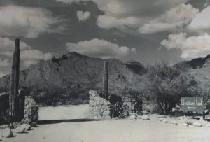
Westward Look
Westward Look, which was just a year ago approximately, the town finally got it after a long time of negotiation. But this was a major fight between environmentalists, community activists, corporations, and the council kind of in the middle trying to decide what to do.
Ultimately some of that land was annexed by Oro Valley, and ultimately there was a corridor preserved, though many of the environmentalists would have liked a much bigger corridor.
(Turning Point 3: Preservation of Steam Pump Ranch slide) George Pusch had established a ranch here at about 1874. The Pusch’s were here until 1925. They lost control of the property in a bankruptcy.
Another gentleman by the name of Jack Procter bought it in the 1930s and held it until 1970, and then he gave it to his grandsons. By then it had shrunk a lot. A lot of it had been sold, and there were only 56 acres left in which this house and other historic buildings were there.
(Homesteads Deteriorated slide) There were at least 38 homesteads in Oro Valley in 1940, but as you can see most of them were not preserved. Many of them were made of very flimsy construction to begin with. They were made of whatever materials were available.
These are two examples of ruins of homesteads that still exist, but all that is really left of both of them are some foundation stones. Many of them were being bulldozed because of construction of subdivisions, and a few people began to look at this and argue that something really needed to be done to save something in the town of its history.
(Steam Pump Ranch – Deterioration slide) As you can see from the picture on the left, this is the Steam Pump Ranch pump house in about 1930, and this is what it looked like in 2003. The property was not being maintained historically. Some of the buildings were not being very well maintained, and the grandsons that owned it wanted to sell it for the maximum profit, which would have been some kind of development—shopping center.
And so that became the question: what’s going to happen?
(Oro Valley Intervenes slide) The article up there on the left is from 1988. Oro Valley annexed the 56 acres, and shortly after that they approved a plan which later became known as Steam Pump Village, that it would be a mixture of different kinds of stores and apartments and other buildings. And that would also not include somewhere between seven and fifteen acres where the historic buildings were, but it was still kind of up in the air at that point as late as the early 2000s.
(Steam Pump Ranch slide) So, a group of activists started to go to meetings. Several of those people ended up being the founders of the Oro Valley Historical Society, and they began to lobby to save these buildings, save this property. That’s my map over there on the left. You can see where Steam Pump Village was—or is—and Oracle Road, and this section of approximately 15 acres would include the pump house, the Pusch House, the Proctor-Leiber house, and some other buildings.
In 2003 the town council committed to obtaining the 15 acres and preserving it as a historic area, but they didn’t have the money. So, the county was about to have another bond issue. Remember I mentioned before the county periodically would put these up.
They came to Oro Valley and said, ‘Do you have something you would like to include in this?” And they said, “Yes, we’d like to include several million dollars for Steam Pump Ranch.” So that went into the package, and it was approved by the voters. And so now the county had money, and the town had made a commitment to obtain the property.
The deal was closed in 2006 to buy the property ultimately for $4.5 million, and then a task force was created to study it and decide what to do. The first building to be restored was the Pusch House in 2011. Currently there are several buildings that have been restored just in the last few years. The pump house has not been restored—it is a kind of recreation of the pump house—but other buildings have been restored. The only major building left is the Proctor-Leiber house to be restored.
(Turning Point 4: Obtaining Water slide) And the last big issue is obtaining water. Where would this community be today if we did not have water? It wouldn’t be here.
The federal government, during the Lyndon Johnson presidency, had passed a law creating the Central Arizona Project. The idea is the federal government gave a large sum of money—I think about $57 billion originally—to Arizona, and then when that canal system would be built, that money would be gradually paid back to the federal government out of your bill. If you look on your bill, there are things in there about the CAP. So, we’re all paying that off very, very gradually. Of course, we’re paying it off with inflated money, so we’re not paying what it was back in 1968. But think of this: 1968. When did Oro Valley finally get access to that water? About 2011.
So just in case you read in the paper all these ideas of how we’re going to solve the water crisis by building a canal from the Mississippi River to the Colorado, etc., these things take a long time. There’s one, two words you have to always remember: lawsuit. Somebody’s always going to file a lawsuit, and then there’s going to have to be a court adjudication, and everything takes time.
And by the way, the CAP, this is one of the places where it comes to in Marana. And the CAP was the ultimate triumph of Senator Carl Hayden, who had been in Congress since 1912, and he was barely able to function in 1968. But he stayed; he was the head of the Appropriations Committee and he got it approved, and then he retired about four months later. That was his ultimate accomplishment.
Tucson was to be a hub for the distribution of this water in this area, but the rules were somewhat unclear about how that was really going to happen. Because it’s one thing to have the water right there, but it’s got to get from there to your house, and that involves a lot of infrastructure—pumps, filtration, pipelines, all kinds of things have to be accomplished.
The water ultimately was delivered to Tucson in 1992, but those people who were here may remember the water was not very attractive. It was brown and it had kind of an odor to it because it was coming through the piping system and picking up particulates, and it wasn’t very popular. So again, anytime somebody talks about how you’re going to solve the water crisis by doing some great engineering project, it takes time. It takes a lot of time.
(Variety of Public and Private Water Sources slide) Oro Valley, even though it was a town, and even though it now controlled Rancho Vistoso, there were many, many different water companies operating in this town at that point. I don’t have an exact number, but I think it was about nine water companies. Some of them were very small, just for a single housing development. Tucson Water Company, the part of the municipality Metro Water, Rancho Vistoso—the developer W. Winkle had a water company, Cañada Hills had their own water company, and there were many private wells. Oro Valley Country Club today is still on private wells. It has its own access to water and is not supervised by Oro Valley at all.
So, Oro Valley, about 1991, the people in the government at that point said, “We’re growing fast, and this kind of system is not going to work. We can’t have all of these different entities pumping water out of the ground and have no kind of central control over the amount of water, the availability, the rates, etc.”
Several of the councilmen actually went door to door one day—I think it was in 1992 or 1993—and they asked people who were customers of Metro Water to sign a petition agreeing that Oro Valley would work hand in hand with Metro Water. And so, they formed a consortium of Oro Valley and Metro Water. That was the beginning of Oro Valley having some kind of water system. The council then began to consider buying up some of these and forming a utility, and in 1996 they purchased Rancho Vistoso Water and Cañada Hills Water and formed a public utility with the Utility Commission. The Utility Commission is responsible to the Town Council.
There was tremendous opposition to this. Lots of people came to meetings and were quite angry because they did not want to lose their little Rancho Vistoso Water Company. They were afraid the rates were going to go up. Well, the rates were going to go up no matter what. They were going to go up because water is going to become more expensive. Water taken from the ground here right now costs about $69 an acre-foot. Water coming from the CAP is about $210 an acre-foot. So as soon as we were going to end up using outside water, it was going to become more expensive. It was kind of inevitable, but it’s an example of the shortsightedness of people at that time.
(Golf Courses and New Development Heavily Use Water slide) In 1970 there were two golf courses. In 2000 there were seven golf courses. All of them are pumping groundwater. They’re all part of the system, so your drinking water is coming out of the same wells that are maintaining these golf courses. And at this point, the golf courses are using up about 1/5 of all the water consumed in Oro Valley. So, you have a lot of development going on, and you also have golf courses using the water, and the groundwater levels are falling. So, we don’t have any CAP water, we don’t have anything else, and at that point, we’re very dependent on groundwater.
(Effluent and CAP Water Delivered from Tucson slide) Between 2001 and 2011, Oro Valley finally got access to water that could be used other than groundwater. Today we’re using more water from other sources. We signed a pact with Tucson in 2001. We agreed to pay for some of the costs Tucson had been holding for the CAP water that we were supposed to get, and we had to pay them for the water they had already paid for. CAP water was delivered to Oro Valley starting in 2011. The other water they were interested in getting was the effluent—the wastewater that goes down the sewer and goes down the CDO and other streams and heads out or goes down pipelines and heads south of here.
At the same time in 2001, Tucson also agreed to take back the effluent water, with the idea that both the effluent and the CAP water would go through the piping system of Tucson. That deal I think is for 40 or 50 years—pretty close. But the reclaimed water comes up a separate pipeline. No mixing. We’re actually almost halfway into that agreement at this point. So, it’s going to be an issue in the future how that’s going to be seen through.
(CAP: Solution or Temporary Fix? slide) Mary Beth Carlile, that I mentioned, was an activist fighting for Catalina State Park, and she was eventually named to the CAP board—a very powerful group that makes all the decisions about that. She said CAP is a wonderful savior for us, Arizona, for a certain length of time, but there is going to come a time when CAP won’t be able to do the job. Some people would argue it’s a postponement of the issue, because as we’re using CAP water—and I don’t mean Oro Valley, but the whole Southern Arizona—we’re also building more houses, and we’re having more use and more demand, and eventually those two graph lines are going to meet.
The question will be what to do. So, the town is trying to stabilize its use of groundwater pumping, but it is becoming more dependent on CAP water. And we all know that there are big questions today about the availability of that water 5, 10, 15 years in the future.
(Contentious Meetings/Citizen Involvement slide) So, we’ve had many, many contentious meetings. If you’re a member of the Town Council, and I was in Pennsylvania, 90% of the meetings are very quiet. Nobody shows up, nobody says anything, and then all of a sudden there’s an issue and you have a room full of people like this, and a lot of angry people speak out on issues. Partly that’s because there was no agreed vision when this town was created. I don’t know if that would even be possible, but we’ve been annexing land and more development. A lot of people were okay with the annexation as long as the land never got developed, but when the plan came out for the development of that annexed land, people were not happy.
They often didn’t realize that a Town Council 10 years ago had already agreed to what would happen to that land, and the current Council had no control over that. So, there was a lot of misplaced anger, but I would argue that we have an educated population here. We have people who are interested and involved, and I think that has made a better community. It’s not always been perfect, but we’ve done the best we can.
(Future Issues for Oro Valley slide) Just quickly, future issues. One of the most dangerous things is we have almost no media coverage today of Oro Valley government. Other than in an article in the Explorer, there is television, radio—virtually no mention. To my understanding, I think only one of the three television networks covered the 50th anniversary of Oro Valley. The other two didn’t even mention it. We got a problem. If our local government—we don’t know what’s going on, the internet is not filling the gap.
And of course, I put a fiscal dilemma that I talked about in my book: since we do not have a property tax, we are very dependent on sales tax revenues. Annexations have been a way of adding revenue, but they also add costs. When you build a shopping center, you need more police. When you build a housing development, you need to improve the water system, etc., etc. So, there’s a lot of things. And I think one of the biggest problems that’s not just here in Oro Valley is that everybody wants services, but nobody wants taxes. We all love the park system we have. It’s a beautiful park system, but parks cost a lot of money. They have to be maintained—not just bought and built but maintained—and that costs money. Any questions?
Audience Member 1: You said in the beginning that when they went to build the park that some people said, “There are no urban parks,” were they just ignorant what was happening in the East in Central Park Hill Park, Philadelphia?
Jim Williams: Most of the national park service did not have many urban parks until the 1970s-
Audience Member 1: Well, those were built–Central Park was built in the 1800s.
Jim Williams: Oh yes, you’re correct. Well, the mindset of the state board in those days was a state park somewhere way out in the desert that you drive out to get to. But this park is probably one of the most heavily used parks in the whole system because it’s so close to people. They weren’t thinking and they didn’t want to spend the money. They knew it would be costly because of the way it was designed. There were only about 4-5 employees – everyone else was a volunteer. So, it’s not very expensive [Central Park].
Audience Member 2: How acrimonious and how long did the fight last for incorporation – fighting Tucson to get Oro Valley incorporated?
Jim Williams: It started 1968, they filed their petitions in 1970 and finished in 1974. But really there were attempts to disincorporate until 1975. So it was over about a 7-year period. You have to give people credit for their “stick-to-it-iveness.” That small group of people – about 15 – were very committed.
Well, I have my books up here if anyone is interested. Thank you for coming!