The Basics…
Most historians agree that Arizona comes from the Spanish interpretation of a Basque phrase “Arizonac” or “Arizonac/Ali Sonak,” meaning “place of small springs.” This referred to a historic mining area near present‑day Nogales, AZ. The name was first applied by Spanish explorers and settlers in the 1700s, who adopted the local Basque‑derived term for the region.
Arizona was officially named a U.S. territory by President Abraham Lincoln on February 24, 1863.
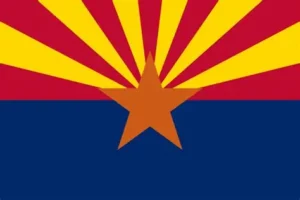
Arizona Flag
Adopted in 1917, Arizona’s state flag blends natural beauty, cultural history, and economic heritage.
- 13 rays recall both the nation’s founding and the vivid sunsets of the Sonoran Desert
- Red‑and‑gold palette honors the Spanish expeditions that first mapped the region
- Copper star reflects Arizona’s long‑standing mining industry
- Deep blue field grounds the design in the national colors and evokes the Colorado River, a lifeline of the Southwest
But did you also know?…
🏜️ Geography, Landscapes & Natural Features
- Arizona has 3,928 mountain peaks and summits, more than any other Mountain State.
- 26 peaks exceed 10,000 feet in elevation.
- Mount Humphreys (12,643 ft) is the highest point in the state.
- Average state elevation: 4,000 feet.
- The lowest point is near Yuma, where the Colorado River dips to 70 feet above sea level.
- Arizona’s climate can produce both the highest and lowest temperatures in the nation on the same day.
- Hottest temperature: 128°F at Lake Havasu City (1994).
- Coldest temperature: –40°F at Hawley Lake (1971).
- Rainfall ranges from under 3 inches in the desert to over 30 inches in the mountains.
- Arizona contains four major deserts: Sonoran, Chihuahuan, Mojave, and Great Basin.
- The Sonoran Desert is the most biologically diverse desert in North America.
- The Saguaro cactus, native only to the Sonoran Desert, can grow as tall as a five‑story building and store up to nine tons of water.
- Cutting down a protected cactus can result in over a year in prison.
- Arizona has 90 wilderness areas, more than the entire Midwest (which has 50).
- 11.2 million acres of National Forest land; one‑fourth of the state is forested.
- Home to the world’s largest contiguous stand of ponderosa pine, stretching from Flagstaff across the Mogollon Rim to the White Mountains.
- The geographic center of Arizona is near Mayer, southeast of Prescott.
🏞️ Grand Canyon & National Parks
- Arizona is home to 22 national parks with over 7 million visitors annually.
- The Grand Canyon is 277 miles long, 18 miles wide, and 1 mile deep.
- Formed by the Colorado River 5–6 million years ago.
- Teddy Roosevelt designated it a national monument in 1908.
- You could stack four 1,300‑foot skyscrapers inside the canyon and still not reach the rim.
- The longest intact stretch of Route 66 (157 miles) runs from Seligman to Topock.
- Meteor Crater near Winslow is the best‑preserved meteor crater in the world.
- Kartchner Caverns contains 13,000 feet of passages and a 21‑ft soda straw stalactite.
- The Petrified Forest holds the nation’s largest deposits of petrified wood.
🏛️ History, Statehood & Cultural Heritage
- Arizona became the 48th state on February 14, 1912, earning the nickname “Valentine State.”
- Statehood was delayed because Feb. 12 was Lincoln’s birthday and Feb. 13 was considered unlucky.
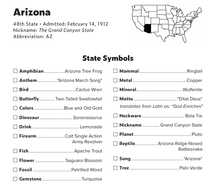
- Arizona’s nickname: The Grand Canyon State.
- Motto: Ditat Deus (“God enriches”).
- Capital: Phoenix.
- Population: 403,000 in 1926 → 7.5 million in 2026.
- Arizona and Hawaii are the only states that do not observe Daylight Saving Time (except the Navajo Nation).
- The Navajo Nation spans 27,000 square miles across AZ, UT, and NM; capital at Window Rock, AZ.
- Oraibi, a Hopi village, is one of the oldest continuously inhabited communities in America (pre‑A.D. 1200).
- Many founders of San Francisco (1776) were Spanish colonists from Tubac, AZ.
- Phoenix began in 1866 as a hay camp supplying Camp McDowell.
- The westernmost Civil War battle occurred at Picacho Pass (1862).
- Geronimo’s final surrender negotiations took place in Skeleton Canyon (1886).
- Sun City (built 1960) was the first 55+ active adult community in the U.S.
🛠️ Mining, Industry & Economy
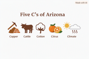
Five C’s of Arizona
Copper — Rich deposits drew European settlers in the 18th and 19th centuries. By the mid‑1800s, one in four residents worked in copper mining.
Cattle — Ranching shaped Arizona’s rural communities. In the early 1900s, nearly two million cows helped feed the nation.
Cotton — Long‑staple Pima cotton became a prized cash crop for farmers at the turn of the 20th century.
Citrus — Irrigation made desert orchards possible, producing oranges, lemons, limes, and grapefruit.
Climate — With about 300 sunny days and only 12.6 inches of rain annually, Arizona’s climate attracted settlers and fueled tourism.
Today, Arizona’s economy has evolved beyond the Five C’s, led by technology, real estate, tourism, healthcare, and government.
- Arizona produces more copper than all other states combined
- Morenci Mine is the largest copper producer in North America
- Bisbee, the nation’s southernmost mile‑high city, once produced 25% of the world’s copper and was the largest city in the Southwest between St. Louis and San Francisco.
- The copper dome atop the State Capitol contains the equivalent of 4.8 million pennies.
- The USDA named Pima cotton in honor of the Pima (Akimel O’odham) farmers who helped perfect the crop in Arizona.
- AZ grows enough cotton each year to make one pair of jeans for every person in the U.S.
- Yuma is the nation’s top producer of winter vegetables, especially lettuce.
- The first barrel of tequila produced in the U.S. rolled off the line in Nogales, AZ in 1936.
- Palo Verde Nuclear Generating Station produces more electricity than any other U.S. power plant.
🏗️ Engineering, Infrastructure & Unique Structures
🎭 People, Pop Culture & Notable Events
📏 Size & Comparisons
- Arizona is the 6th largest state (113,909 sq mi).
- All of New England plus Pennsylvania could fit inside Arizona.
- Coconino County is the second‑largest county in the contiguous U.S. (18,608 sq mi).
- Massachusetts could fit inside Maricopa County.
- The two largest manmade lakes in the U.S.—Lake Mead and Lake Powell—are in Arizona.
And finally:
- Roadrunners in Arizona can run 17 mph!
